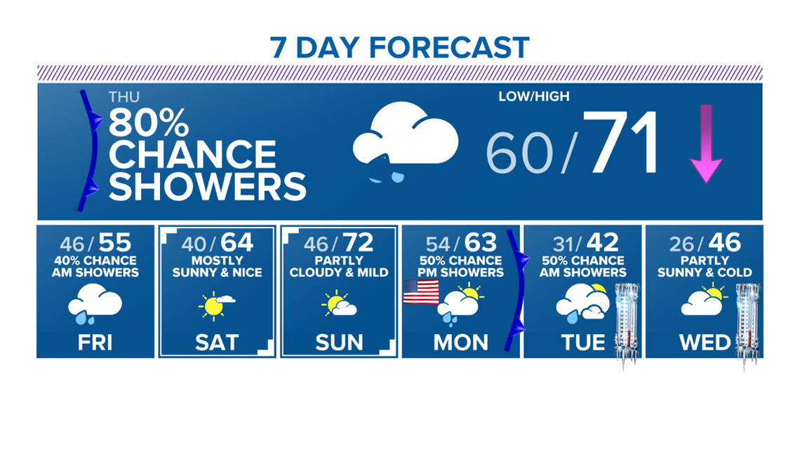
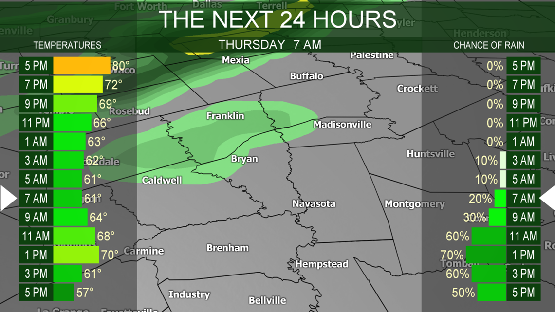
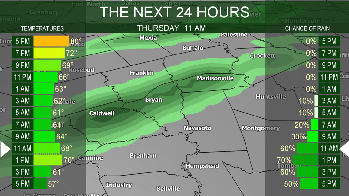
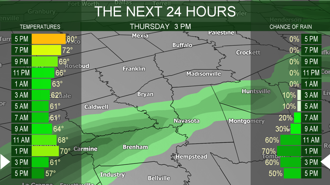
BRYAN, Texas — I hope you enjoyed the above average temperatures over the past few days because big changes are in the forecast. Thursday will be a day of transition. The spring-like weather will abruptly turn to winter-like weather as a Canadian airmass moves into the Brazos Valley. Temperatures will start out in the upper-50s & lower-60s and warm to around 70 degrees before the cold front arrives. The cold front should move in by late-morning for the northwestern Counties, just before noon in Bryan-College Station and around 2:00 pm for the southeastern Counties. Initially, the front will just be a shift in the winds from the southeast to the north at about 20-25 mph. The cold air will take a couple of hours to move into the Brazos Valley; however, by the time you leave work on Thursday afternoon, feels-like temperatures will be in the 40s so pack the jacket.

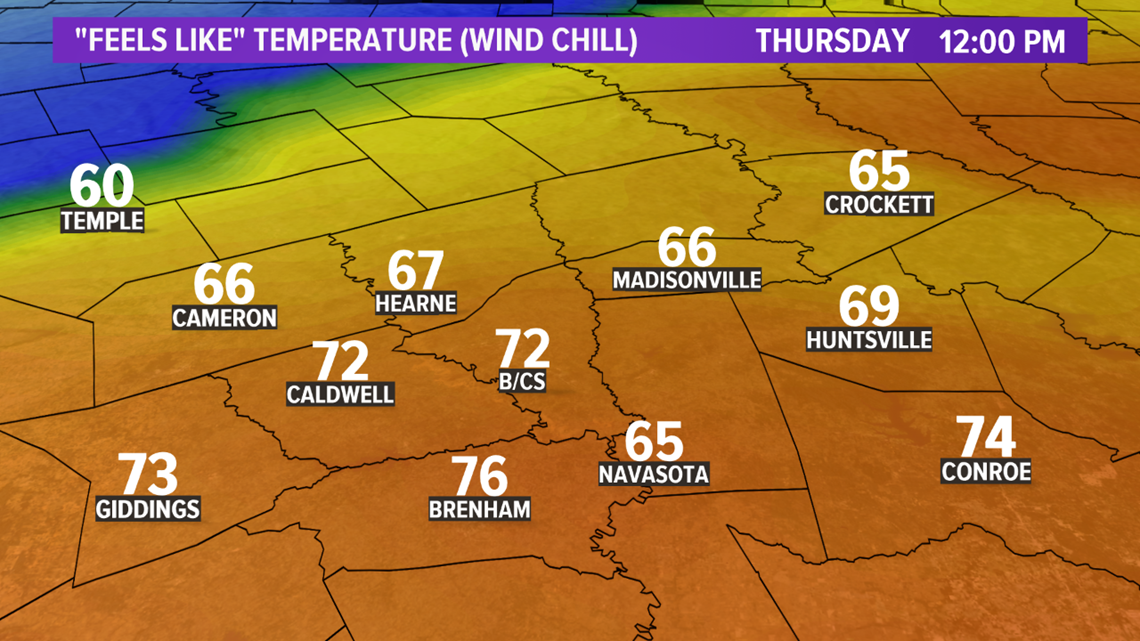

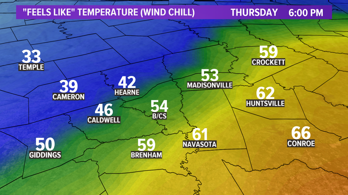
Along with the strong northerly winds and the cooler temperatures will be an increase in cloud cover & rain showers. Rain chances are at 80% tomorrow afternoon. The best rain chances will be just ahead of the front and immediately behind the passage of the cold front. Rain chances gradually diminish into Thursday evening but we will hold on to a 40% chance for a few showers into early Friday morning. The cloud cover will hang tough.



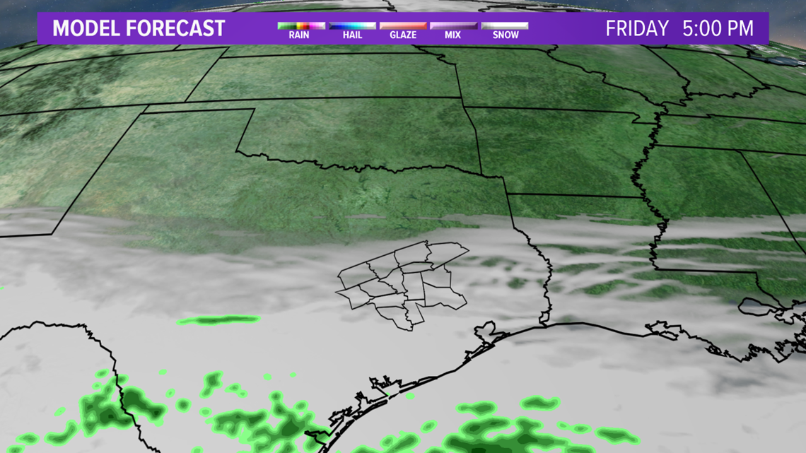
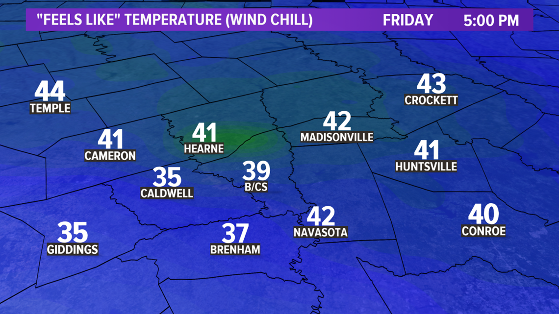
Friday will be chilly. Temperatures will stay in the 50s. Along with the cool temperatures, cloud cover should hang around on top of a northerly breeze. This will make the feels-like temperatures rather unpleasant. The feels-like temperatures should remain in the upper-40s. A shock to the body after the spring-like weather early this week. Temperatures will warm into the weekend into the 60s & 70s but big changes arrive early next week.


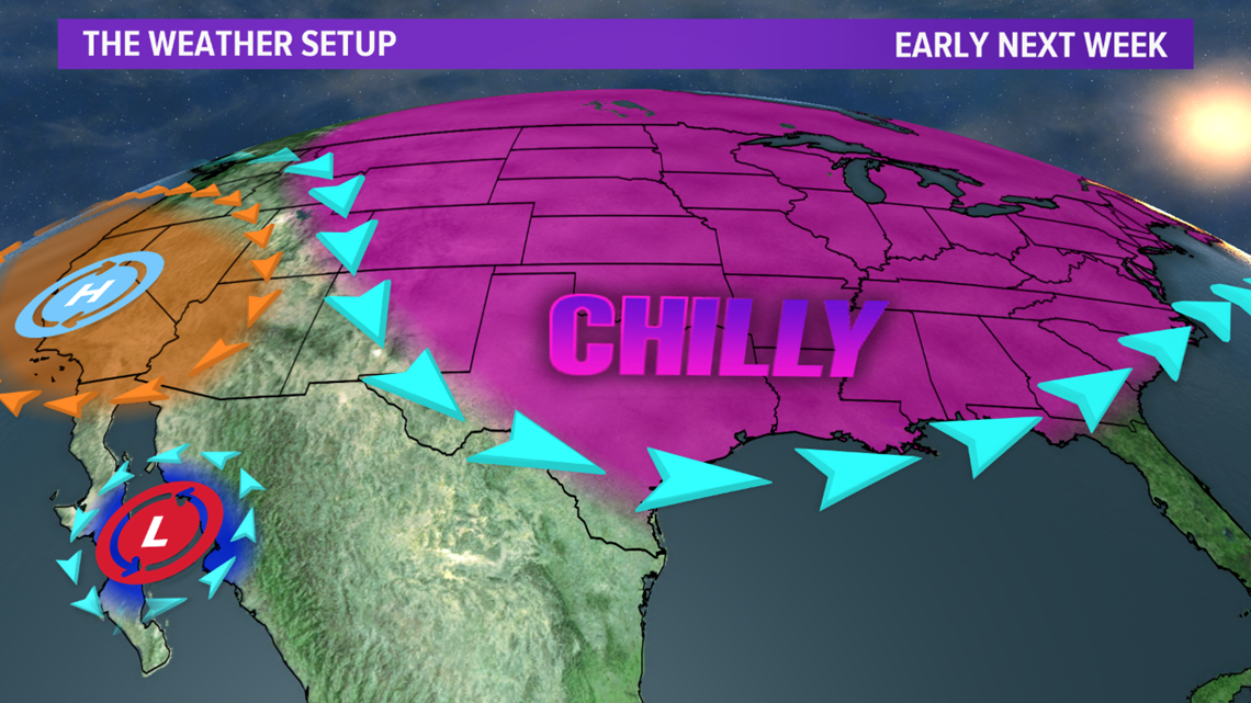
The first true Arctic airmass of the season will move into the Brazos Valley thanks to a huge dip in the jet stream. The timing of the Arctic airmass is a little up in the air. Numerical guidance is all over the place with the timing of the cold front on Monday. Typically, numerical guidance struggles with these dense, cold airmasses so I believe the cold front will move in earlier in the day Monday. This will prevent high temperatures from climbing too much (Note: if the cold front is slower that I am projecting, highs will climb into the 70s). Behind the front temperatures will quickly fall into the 30s with windchills in the teens.

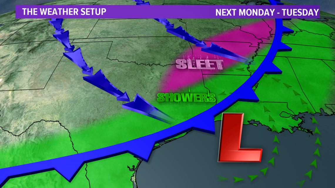
An area of showers will accompany the cold front along with a few hours of post-frontal precipitation as moisture gets wrapped into the cold airmass. At this time, it appears the moisture will scoot out to the east just before the airmass gets cold enough for sleet. However, just to the northeast of the Brazos Valley, there *could be a brief window for sleet. It is entirely too early to iron out the exact details of the moisture & cold air but chances are low for wintry precipitation in Bryan-College Station at this time. It also appears any sleet to the northeast would be *very brief if it occurs. I will continue to monitor this setup closely and provide updates as needed.

Temperatures will be downright frigid behind the cold front. High temperatures will struggle in the 40s with lows in the 20s. Windchills will be in the teens. This is dangerous cold. Make sure you prepare in advance.

