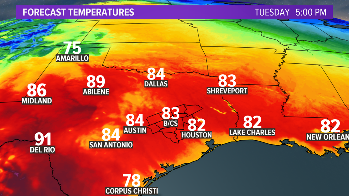
BRYAN, Texas — Moisture is beginning to work back into the Brazos Valley. This will allow for a cloudy start Tuesday morning with temperatures in the mid-60s. A few areas of patchy fog are possible across the southern zone.

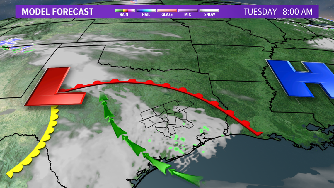

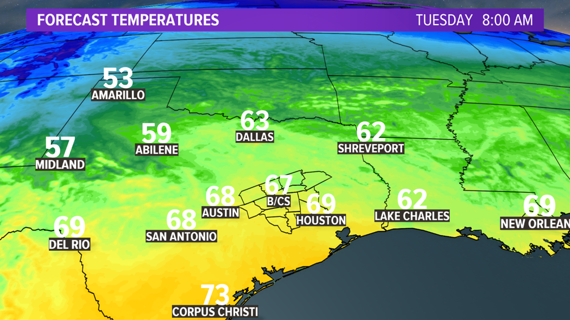
The cloud cover will begin to breakup by late-morning, leading to temperatures climbing into the mid-80s.

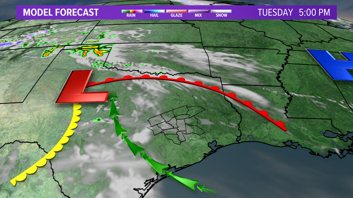

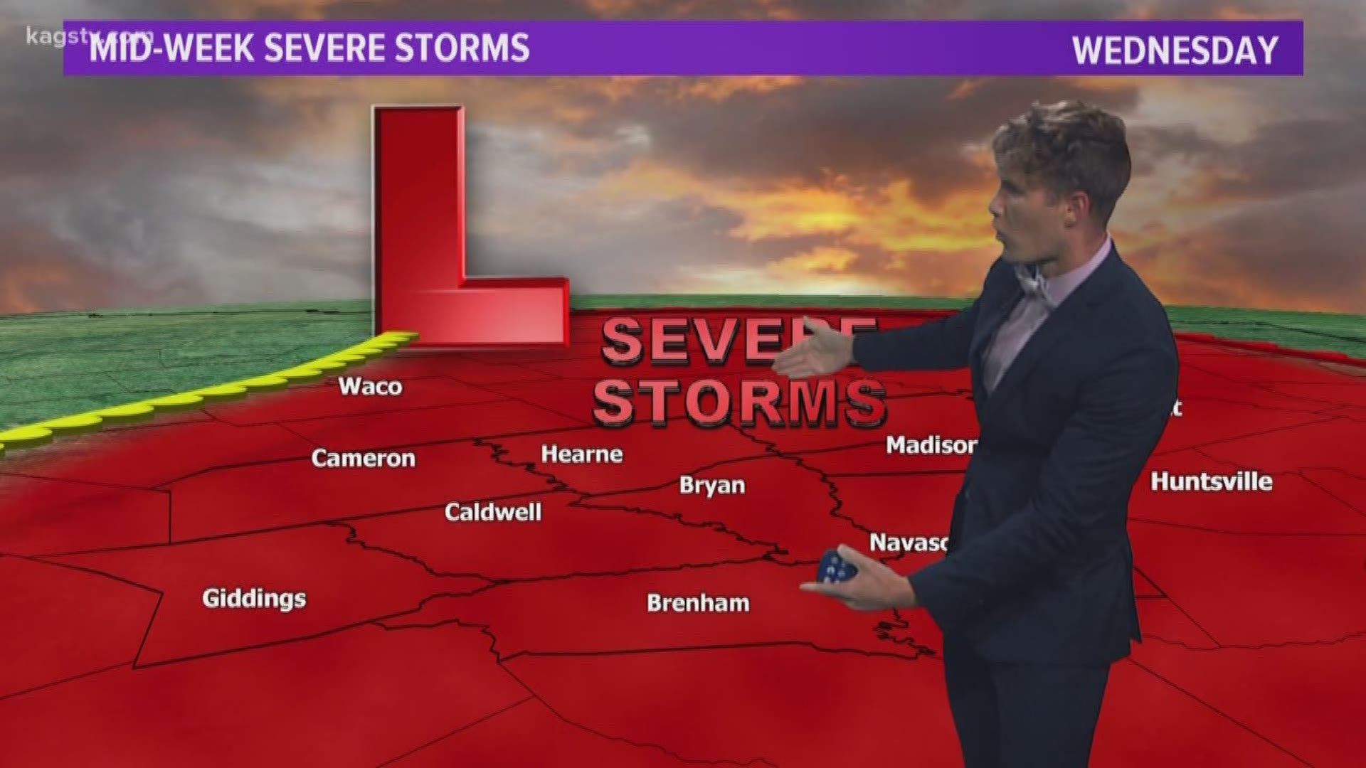
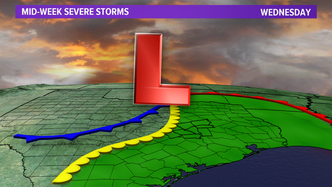
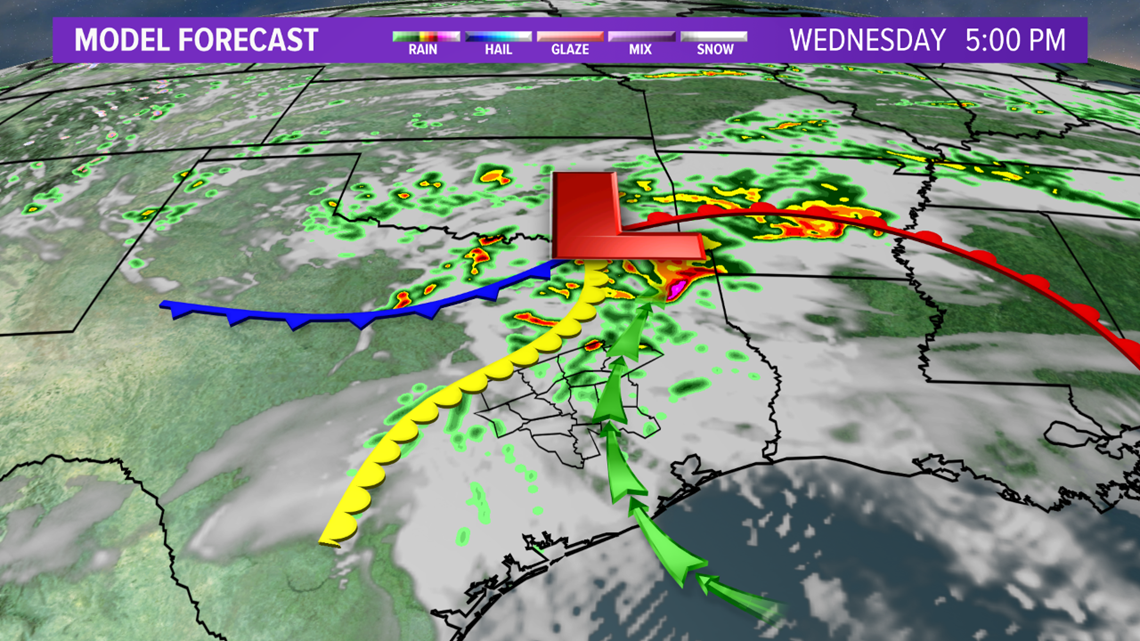
The moisture will continue to advance north through the region on Wednesday as a low pressure starts to get its act together across northwestern Texas. This may lead to isolated showers and storms early Wednesday. This activity will be isolated in nature and below severe levels due to it being elevated. The low pressure will advance east across the Red River Valley throughout the Wednesday as an upper-level disturbance moves into the Southern Plains. This will provide a second opportunity for thunderstorm activity across the Brazos Valley Wednesday afternoon as dryline pushes into the I-35 corridor. If enough daytime heating occurs, after the morning thunderstorms, fairly intense thunderstorms may develop along the dryline and move into the Brazos Valley.


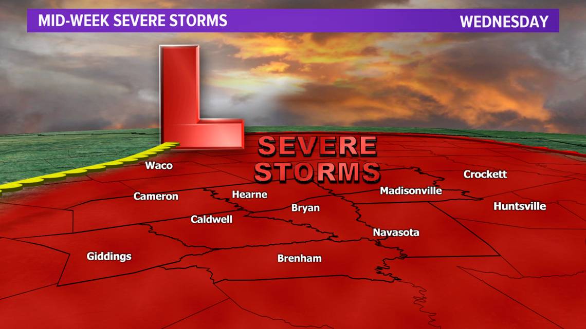

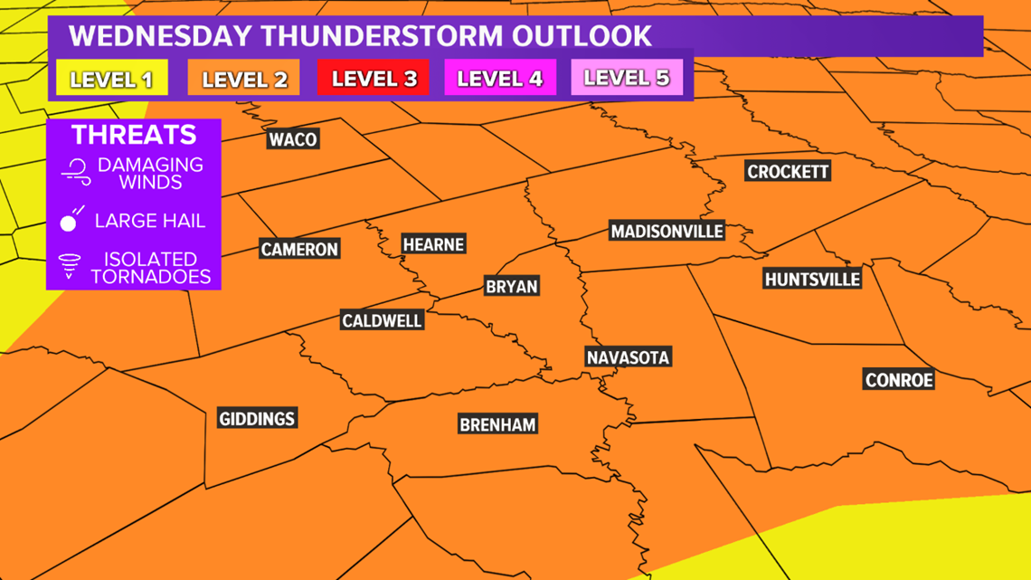
There is a Level 2 risk for severe thunderstorms Wednesday afternoon into the evening hours. Large hail and damaging winds are the main hazards but an isolated tornado cannot be ruled out. Very large hail may be possible if enough daytime heating occurs. Also, there may be an elevated tornado risk across the northern zone. This will be determined over the next 24 hours.

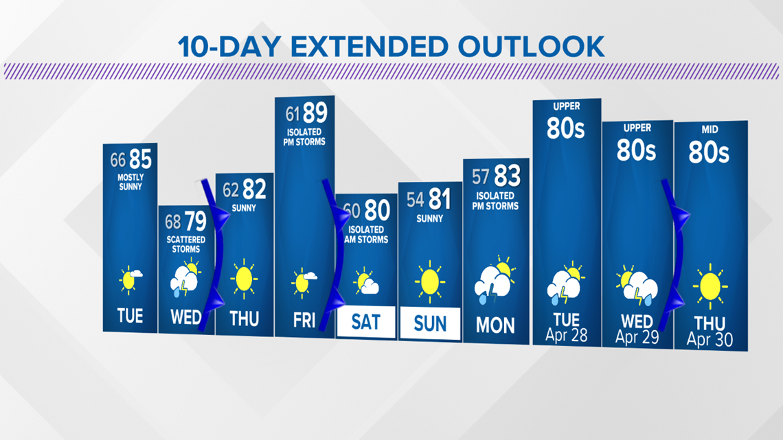
Temperatures remain above average through the end of the week.

