BRYAN, Texas — Stubborn low clouds kept temperatures on the cool side across the Brazos Valley Monday. A few areas of fog may redevelop early Tuesday morning across the area but it shouldn't be as dense and widespread as what was observed Monday.
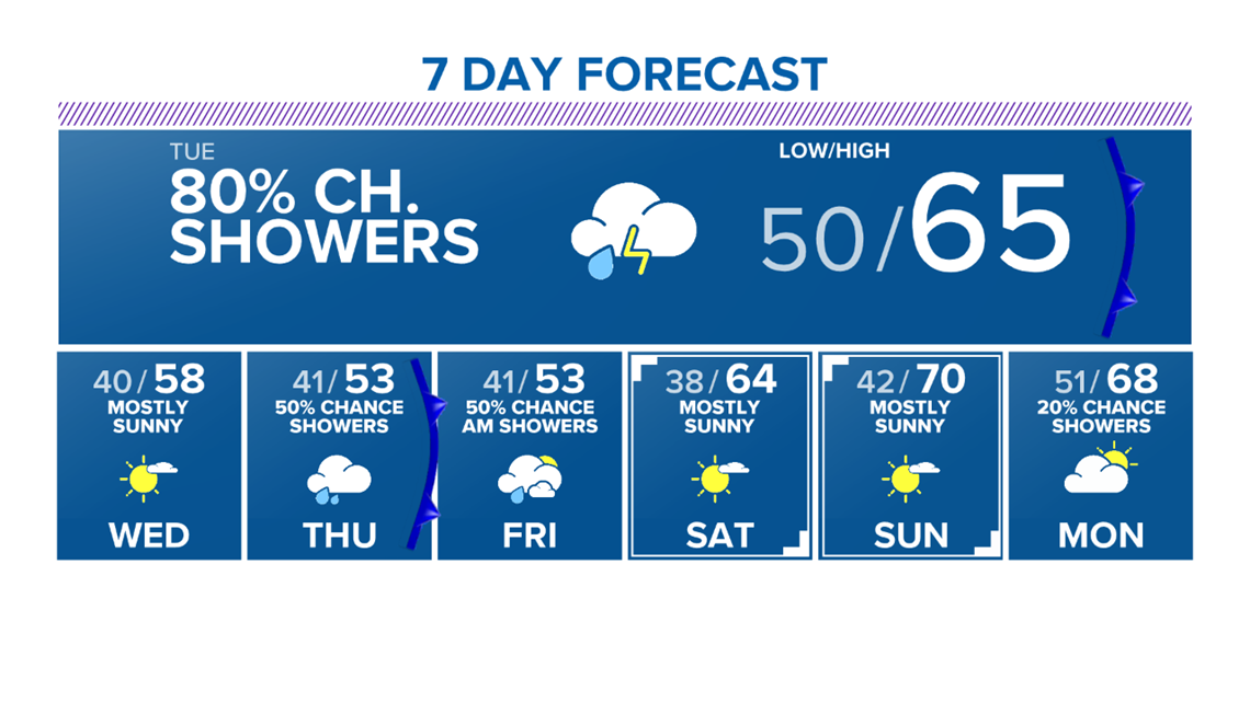
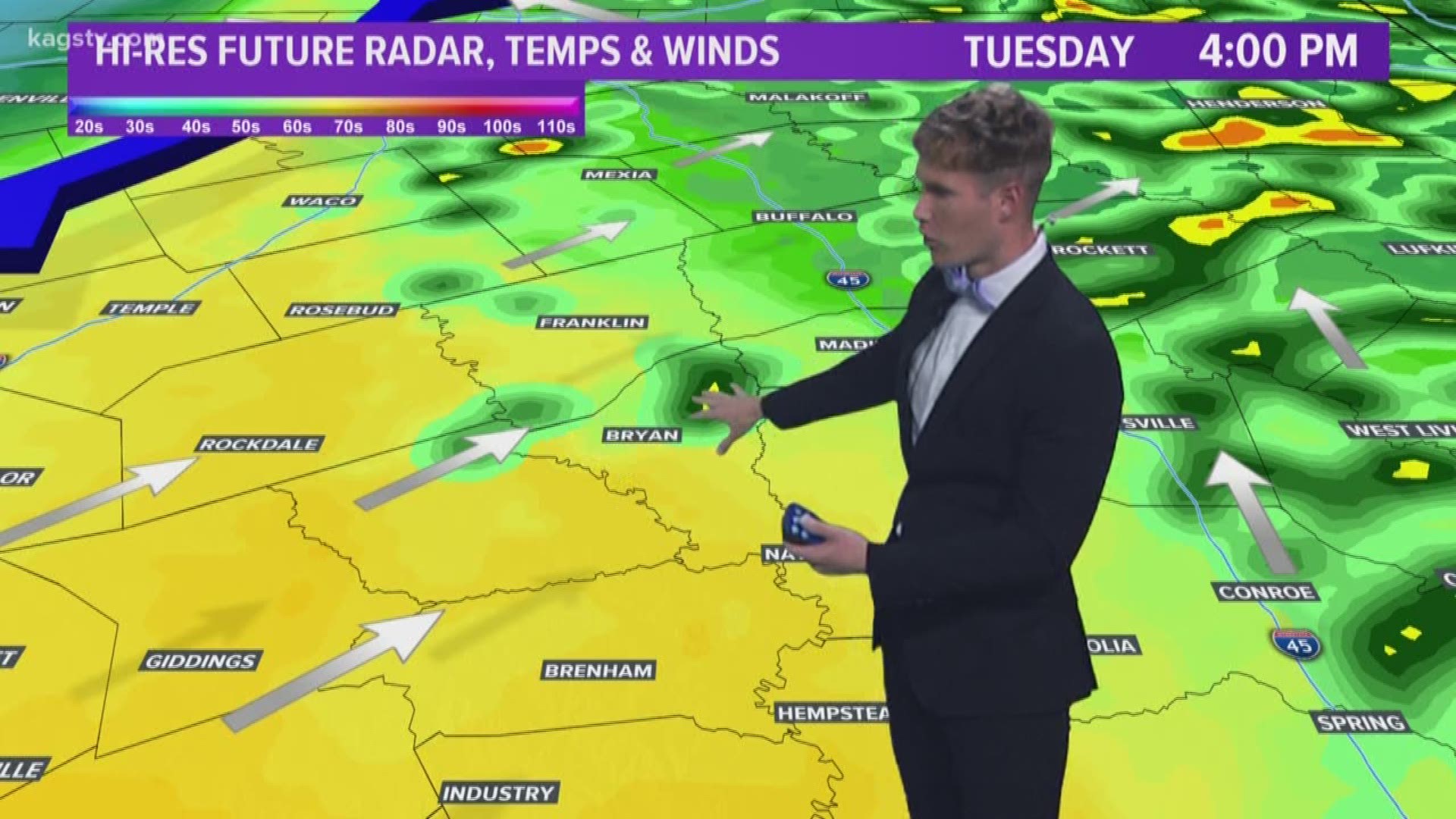
The main focus of this forecast is an upper-level trough that will move into Texas Monday night into Tuesday. This upper-level trough will allow a surface low to quickly spin-up in western Texas Monday night. The surface low will help moisture move north through the Brazos Valley, which will set the stage for rain. The first rain chances enter the forecast Tuesday morning as a piece of energy moves across the area on the east side of the trough. This will spark a line of showers and thunderstorms that will move through around sunrise. These storms are not expected to be severe but a couple rumbles of thunder and brief heavy rain cannot be ruled out. Make sure you have a rain jacket and umbrella handy as you head out of the door. Temperatures will start out in the low-50s.

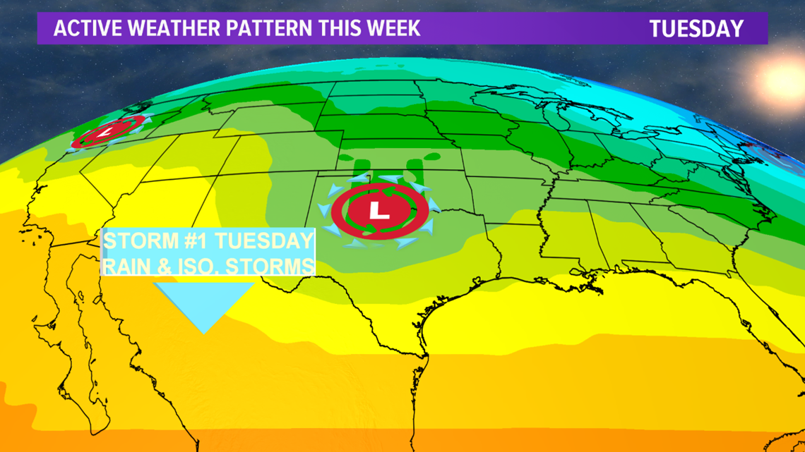

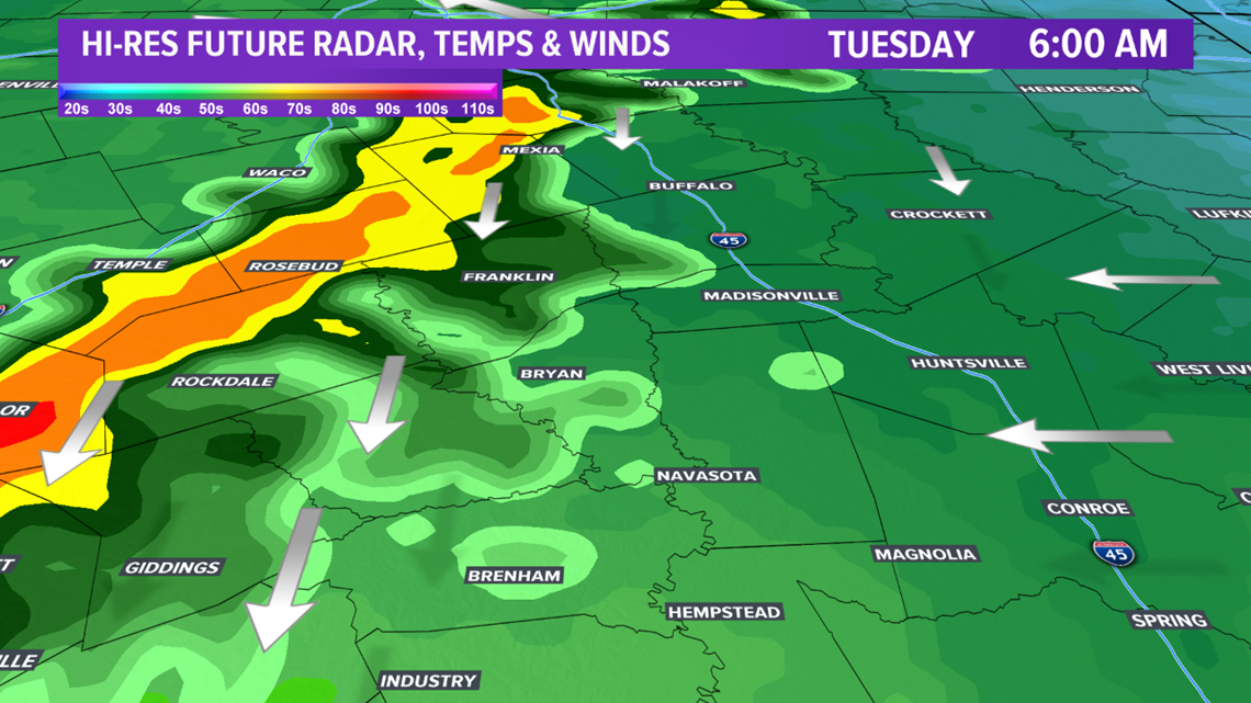

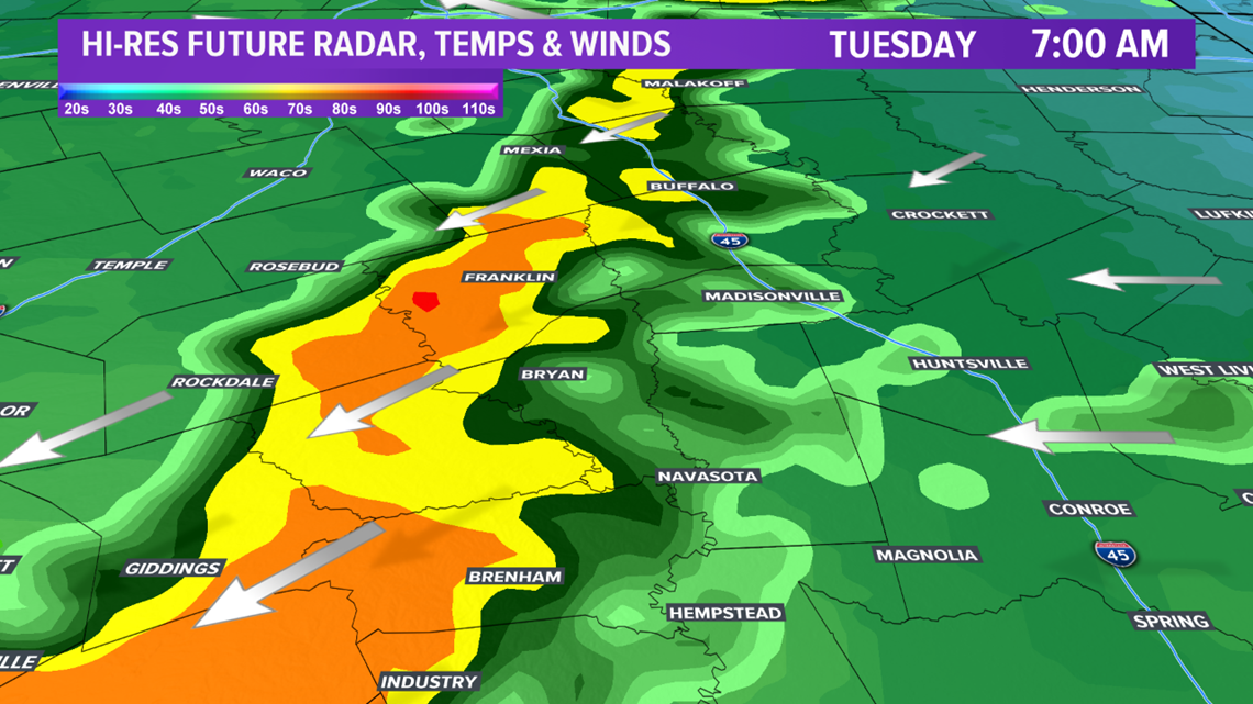

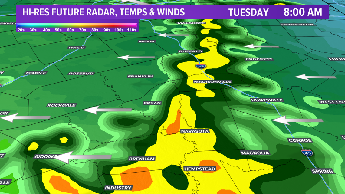
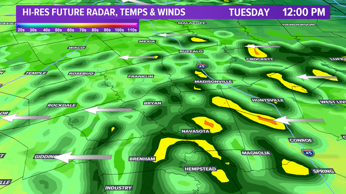
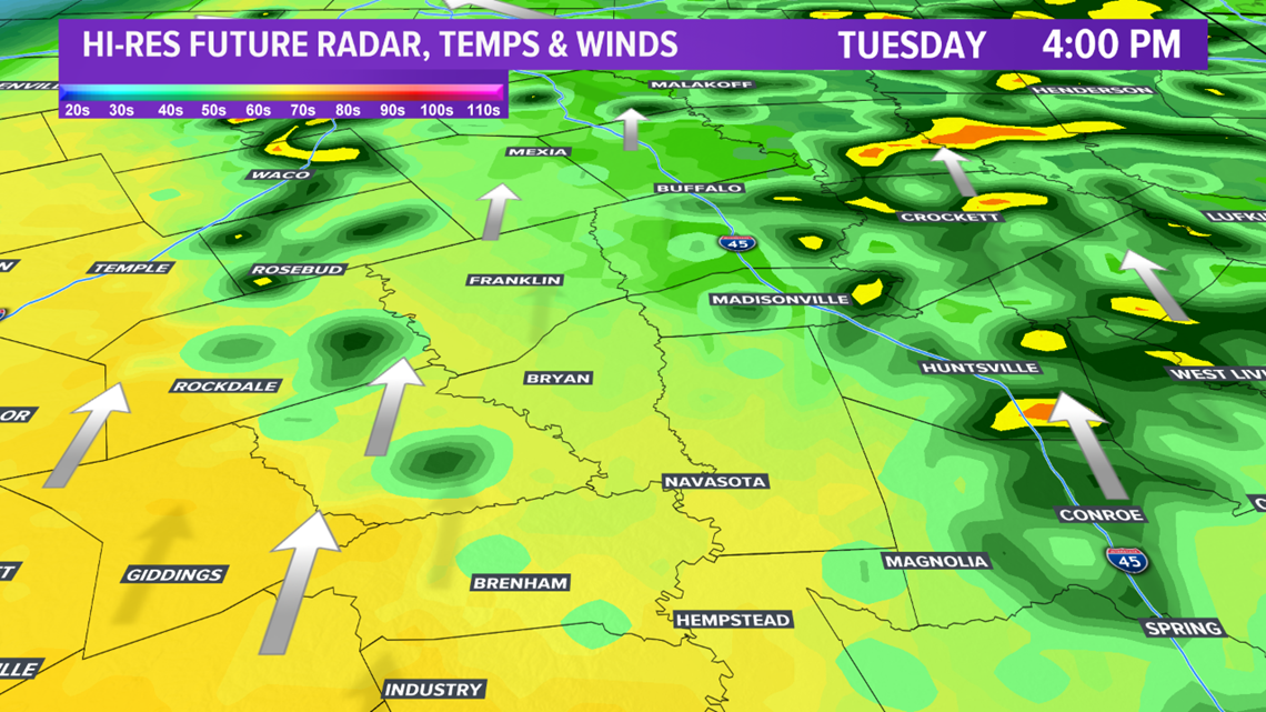
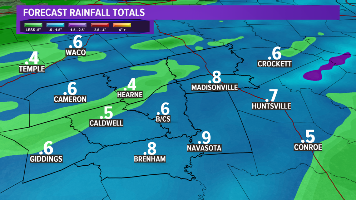
More shower & isolated storms breakout ahead of a cold front late-morning into the afternoon hours for the Brazos Valley. The surface low will track across the Red River Tuesday afternoon, which will surge the cold front south into the area. A line of showers & storms may develop along this front if enough daytime heating occurs out ahead of the cold front. Temperatures should climb into the mid-60s. No severe weather is expected. The Brazos Valley can expected around 0.50" of rain with a few areas received 0.75".



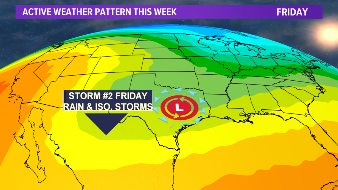
Drying conditions expected Tuesday night and Wednesday after the cold front moves through. A second upper-level trough will dig south into northern Mexico on Thursday. This will increase rain chances on Thursday into Friday as the system moves toward the Brazos Valley. This system will track farther south so rain chances & cooler temperatures look likely. Still some big questions with this system so stay tuned as changes will be needed to the extended forecast.

