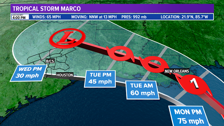
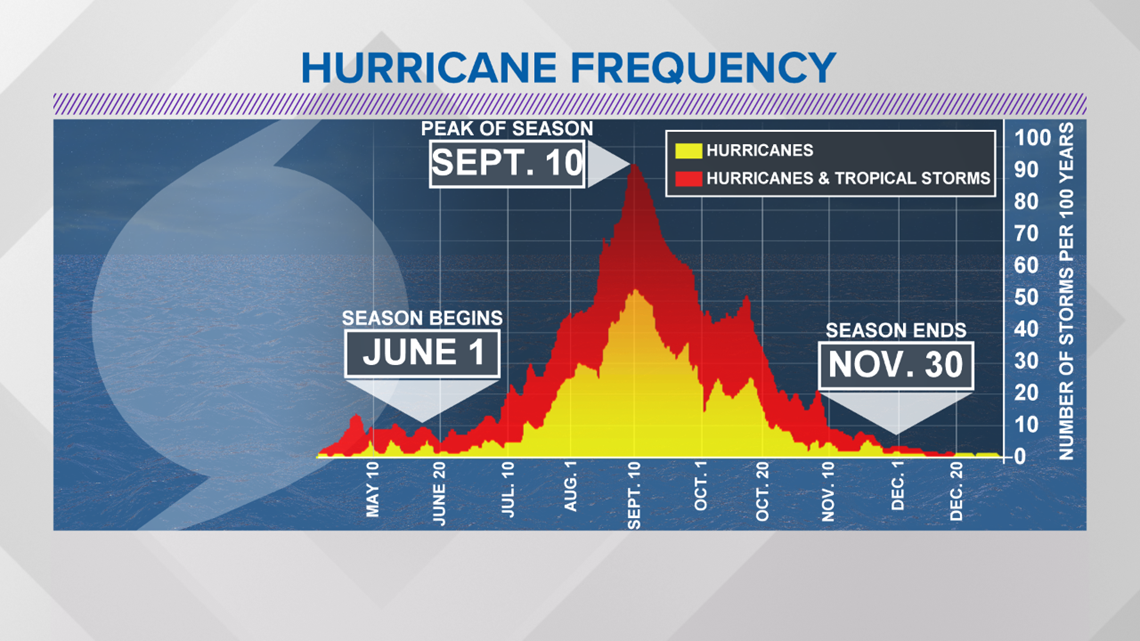
BRYAN, Texas — The peak, September 10th, of the Atlantic Hurricane Season is upon us as we head into late-August and early-September. The tropics have really begun to heat up over the past few days with the development of Tropical Storm Laura and Tropical Storm Marco.

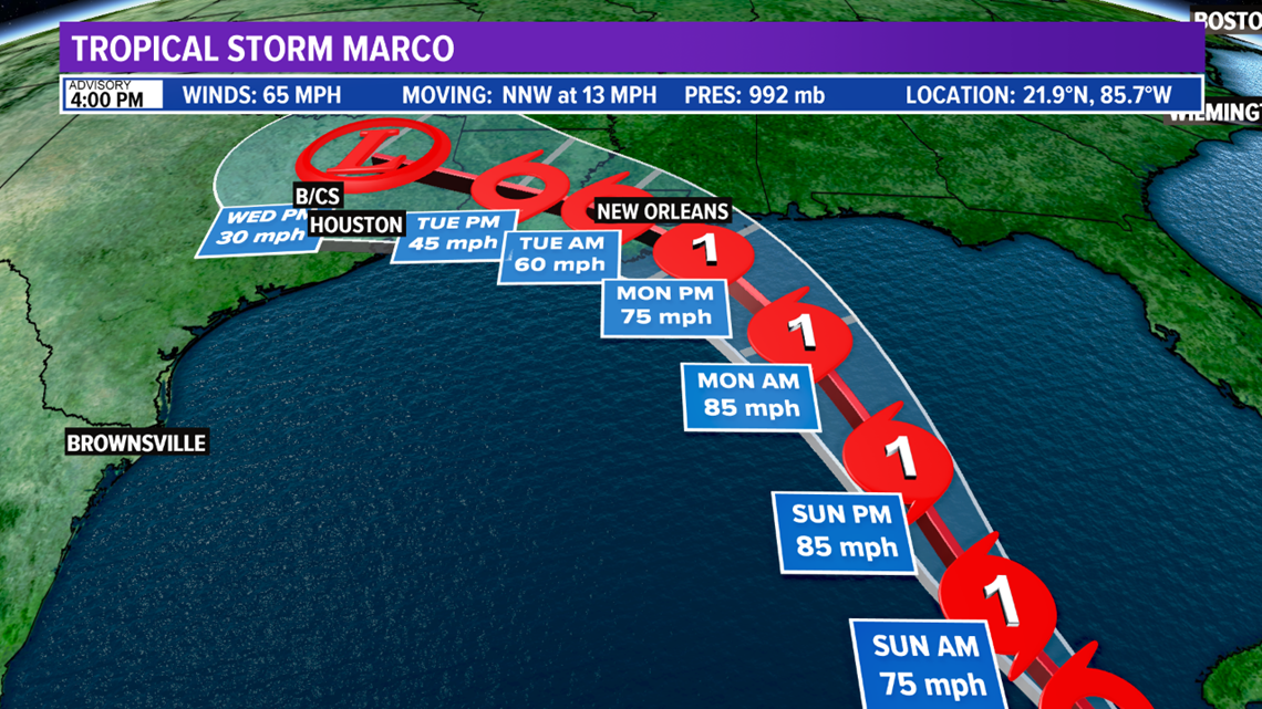
Tropical Storm Marco continues to intensify on Saturday and is now a 65 mph storm. The National Hurricane Center calls for Marco to continue moving northwest and intensify into a Hurricane late-Saturday. The recent update from the National Hurricane Center significant alters the forecast track of Marco. Marco is now forecast to make landfall in Louisiana.

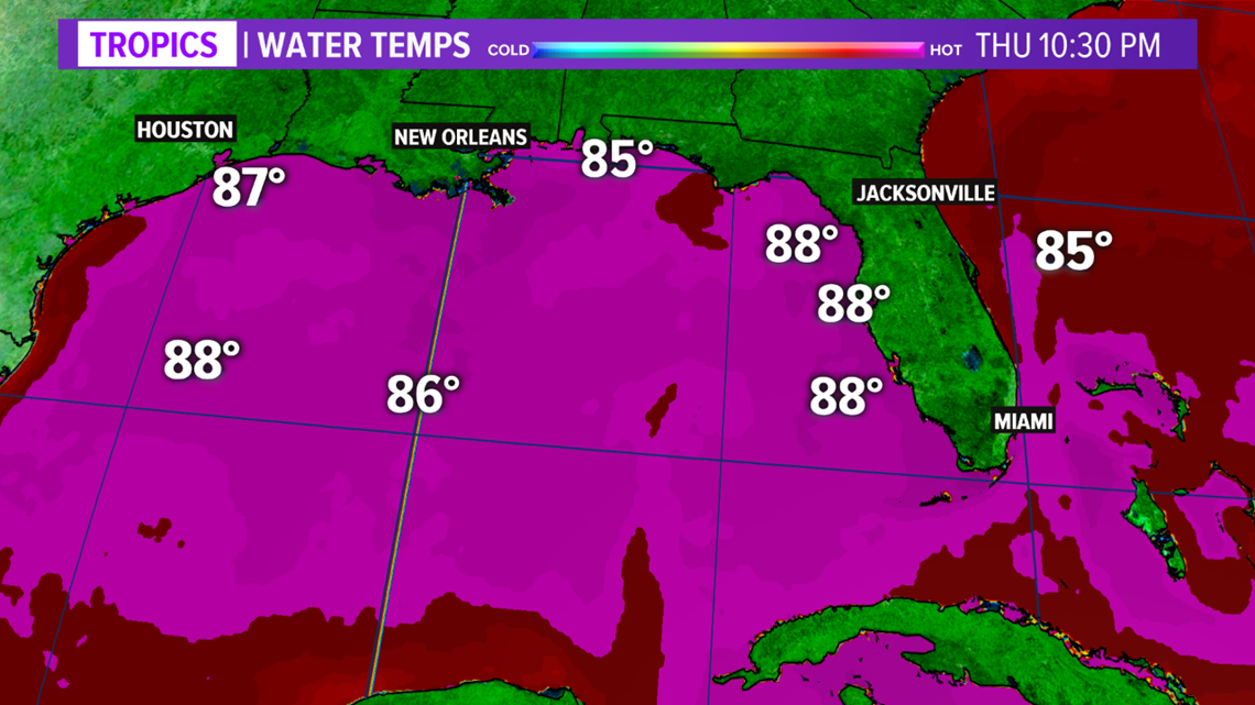
Marco will move into the southern Gulf of Mexico on Sunday. Gulf of Mexico water temperatures are extremely warm and wind shear is forecast to be light through mid-week. This will allow the system to begin ramping up in intensity again before approaching the Louisiana coast on Tuesday. The National Hurricane Center indicates this system will approach the coast as a Hurricane.


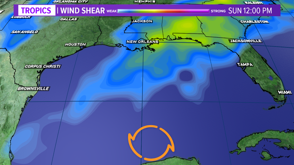

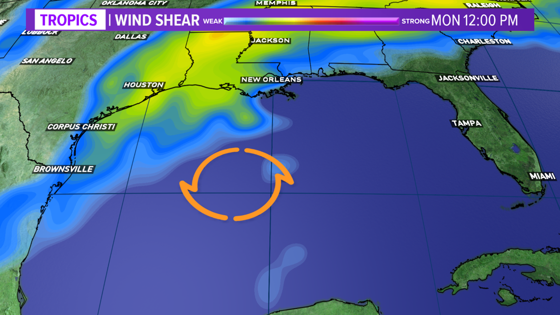
The latest indications suggest this system will approach the Louisiana coast on Monday, make landfall Tuesday, and then work west over Louisiana instead of over the northern Gulf of Mexico. This will lessen the impacts across the Brazos Valley. However, it should be noted upper-Texas coast is under the cone of uncertainty so we cannot write of this system. Other changes in the forecast track can be expected over the coming days.


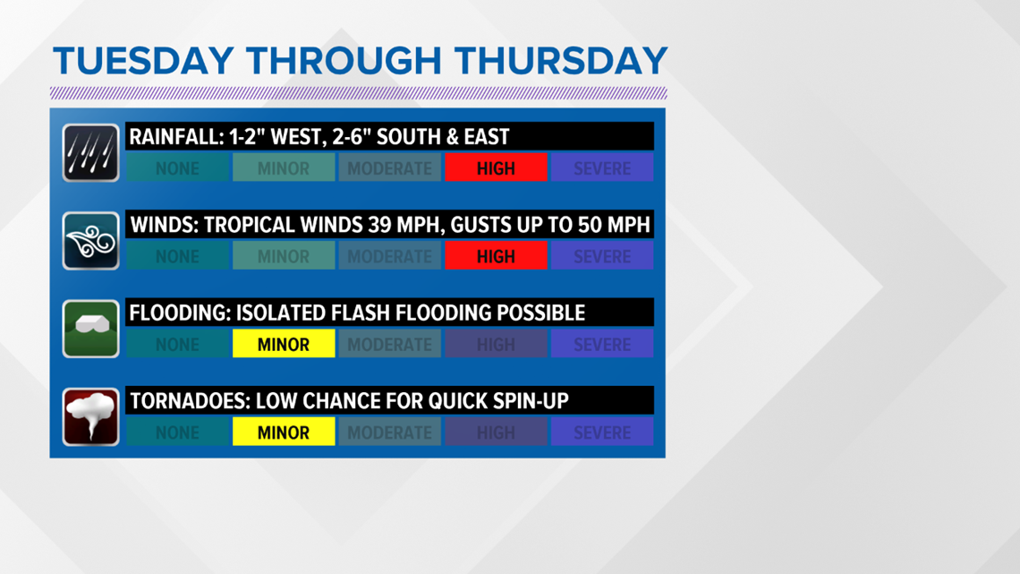
The impacts will be lessened but the Brazos Valley can still expect to see these impacts: heavy rain, strong winds and isolated tornadoes.

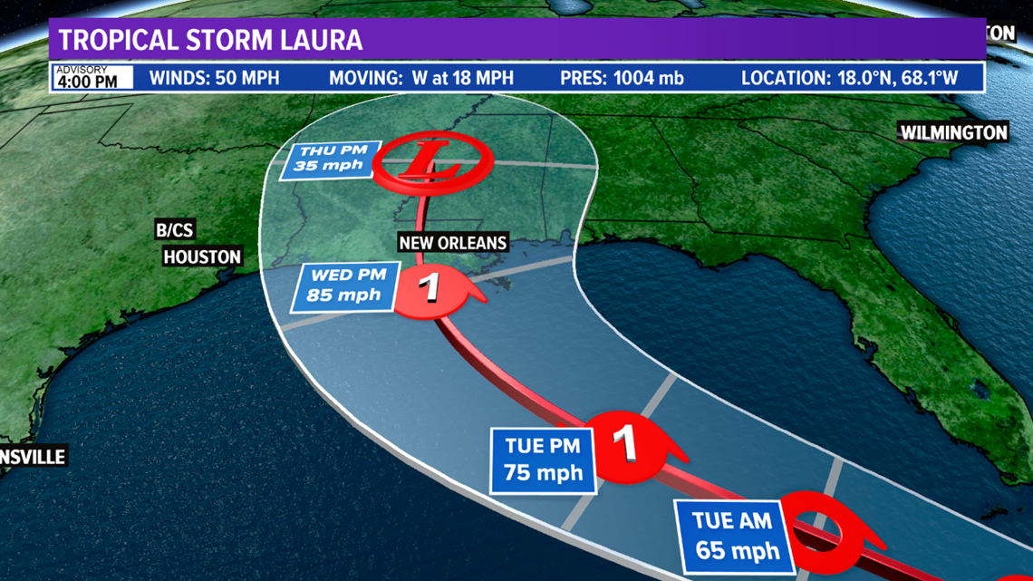
Tropical Storm Laura also needs to be closely watched. Recent model guidance continues to shift the track west and the National Hurricane Center now forecasts a landfall in Louisiana as a Hurricane late-Wednesday but eastern Texas is included in the cone.

All residents along the Texas coast need to prepare as if a hurricane were approaching. Here is a list of important items you should have at home or take with you if you are required to evacuate:
- Water - at least 1 gallon daily per person for 3-7 days; also fill bathtub and other containers; Gator Aid is good to fend off dehydration
- Food - at least enough for 3-7 days; non-perishable packaged or canned food; juices; foods for infants or elderly family members; snack foods; food for special diets
- Non-electric can opener
- Cooking tools, fuel
- Paper plates and cups, plastic utensils
- Bedding: Blankets, Pillows, etc.
- Clothing
- Rain gear
- Sturdy shoes
- First Aid Kit, Medicines, Prescription Drugs
- Toilet paper, paper towels, trash bags
- Toiletries, hand sanitizer, hygiene items, moisture wipes, dry shampoo
- Flashlight, batteries, lantern
- Radio: Battery operated and NOAA weather radio
- Telephones: Fully charged cell phone with extra battery; chargers; traditional (not cordless) telephone set
- Cash (with some small bills) and Credit Cards: Banks and ATMs may not be available for extended periods
- Important documents: Place in a waterproof container or watertight resealable plastic bag: Should include insurance, medical records, bank account numbers, Social Security card, prescriptions, etc.
- Tools: Keep a set with you during the storm
- Gas: Fill up your vehicles several days before landfall is expected; Gas stations could lose power during a storm and supply trucks may not be able to reach the area
- Pet care items: Proper identification, immunization records, medications, ample supply of food and water; a carrier or cage; muzzle and/ or leash
- Bleach without lemon or any other additives
- Fire extinguisher
- Mosquito repellent
- Keys
- Toys, books and games for children
- Duct tape
- Cell Phone charging stations - locations where you can charge mobile devices

