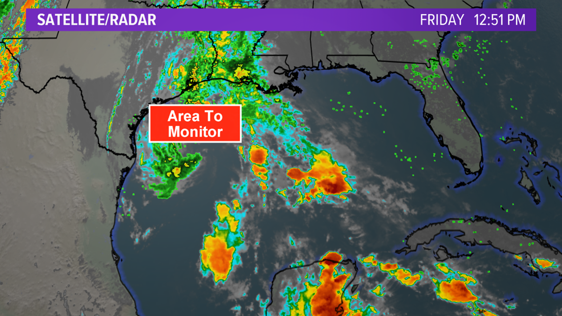
TEXAS, USA — The area of disturbed weather over the northwestern Gulf of Mexico has slowly organized and is now a well-defined low pressure that has a shot for tropical development late-Friday. While the low pressure is well-defined, there is still a noticeable lack of thunderstorm activity associated over the center of the low pressure. The lack of thunderstorm activity is the only variable keeping this system from becoming a Tropical Depression or Tropical Storm.

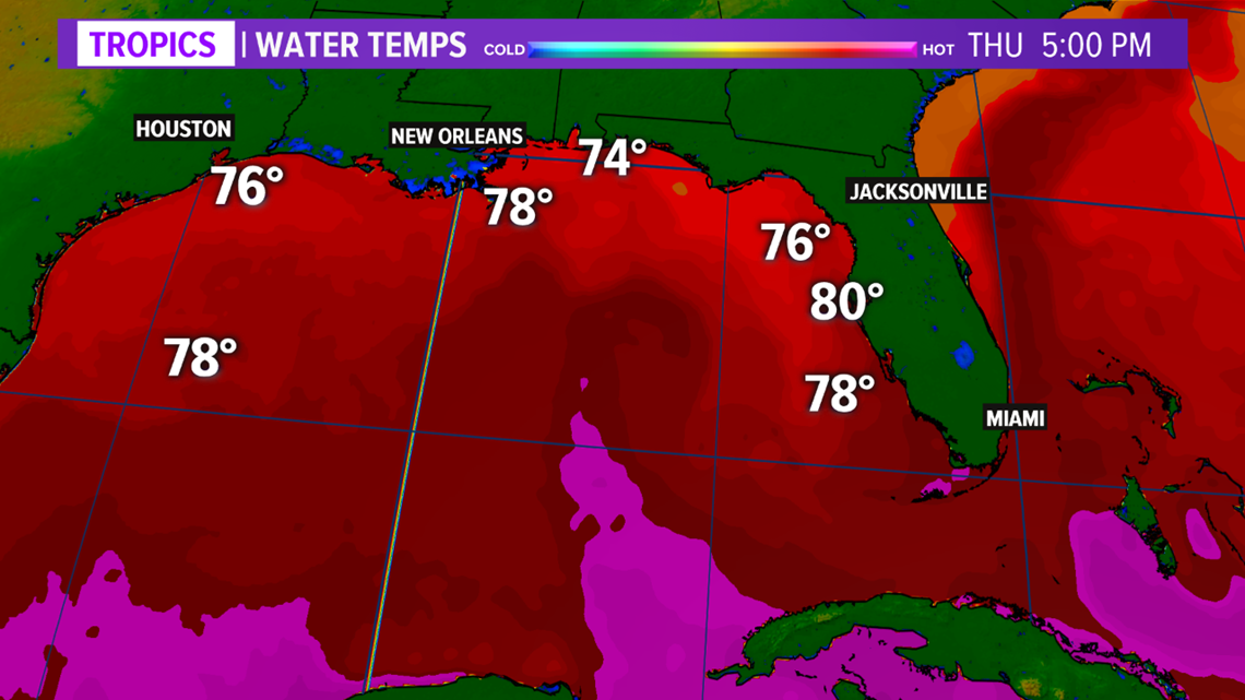
The environmental conditions are beginning to become less favorable for tropical development as the low moves over cooler waters. The water temperatures decrease from the low-80s over the central Gulf of Mexico to the mid-70s off the Texas coast. This will inhibit rapid development of the low pressure.

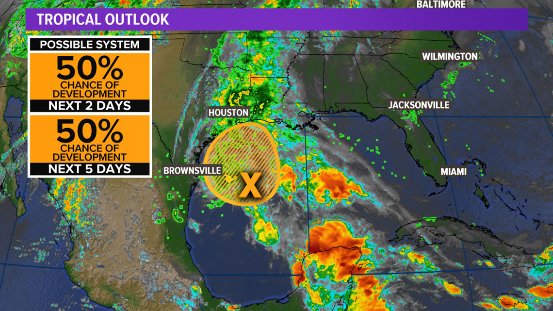
The National Hurricane Center is monitoring this area of low pressure over the northwestern Gulf of Mexico but has decreased the chance for tropical development to 50% late-Friday. If the system were to begin developing convection, Tropical Advisories would be issued for parts of the Texas coast late-Friday but this is a low possibility.

A building upper-level high over the Southeast will help steer this low pressure north Friday, spreading deep moisture and heavy rain into southeastern and coastal Texas. These areas have already received excessive rainfall amounts over the past week so heavy rain will increase the flood threat. The intensifying low pressure would act to increase the tornado potential along the upper-Texas coast late-Friday.

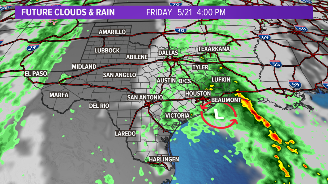
Regardless of tropical development, the low pressure will spread isolated heavy rain into southeastern and coastal Texas Friday. If the low pressure gains tropical characteristics, it would likely remain weak--becoming a Tropical Depression or weak Tropical Storm, making landfall late-Friday along the upper-Texas coast. The 2021 Atlantic Hurricane Season begins June 1st.


