BRYAN, Texas — Clouds are on the increase across the Brazos Valley as a storm system approaches Texas from the west. The increase in clouds, paired with southeasterly winds, will keep overnight temperatures warmer than last night. Temperatures will range from the mid-to-upper-30s across the northeast zone to the low-40s across the southern zone. Precipitation will begin to overspread the area after midnight, continuing into Wednesday morning. The majority of the area will see a cold rain but a brief rain/snow mixture is possible from Crockett to the northeast. No accumulations are expected.

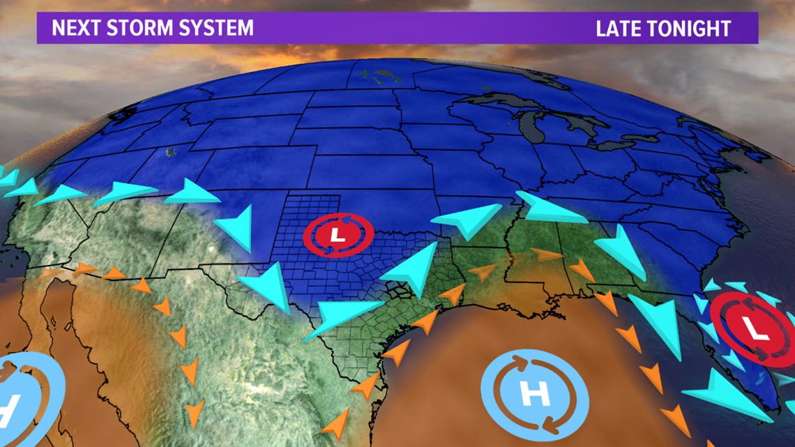

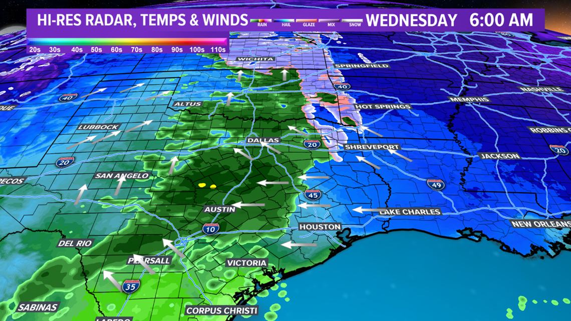
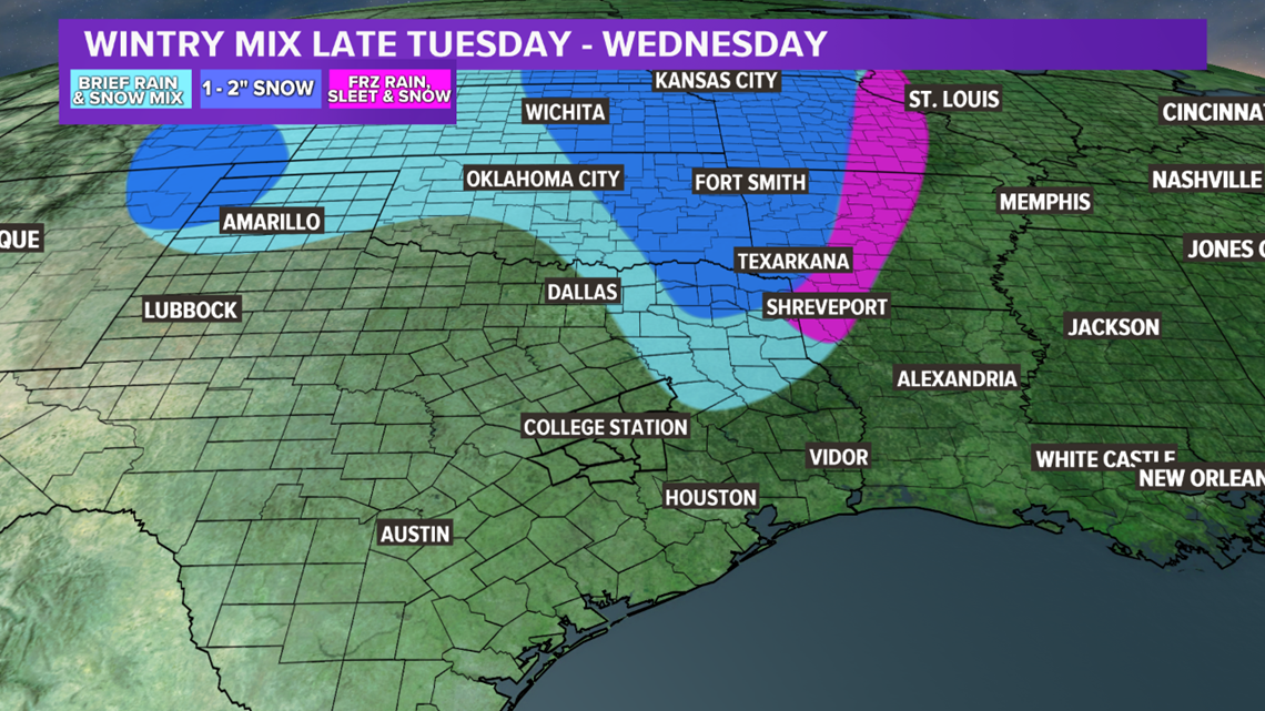
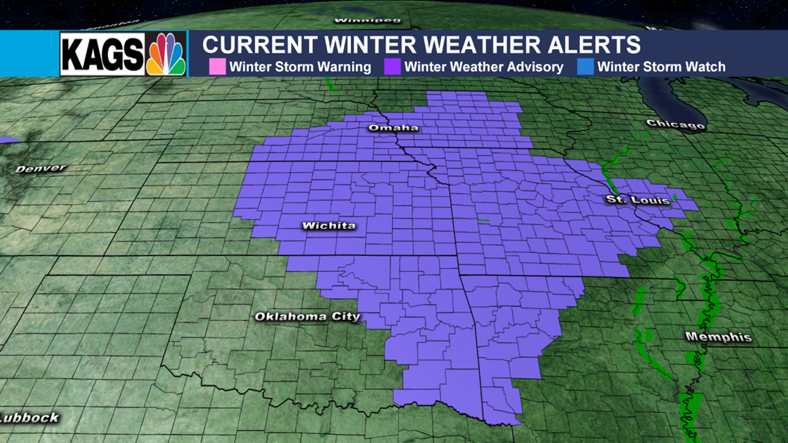
Farther north & northeast, a longer window for wintry precipitation does exist. Northeastern Texas, eastern Oklahoma & northwestern Louisiana have a shot to see accumulations on Wednesday morning. 1-2" may accumulate across eastern Oklahoma & western Arkansas. A Winter Weather Advisory is in place for those areas. Keep this in mind if you have any travel plans northeast.


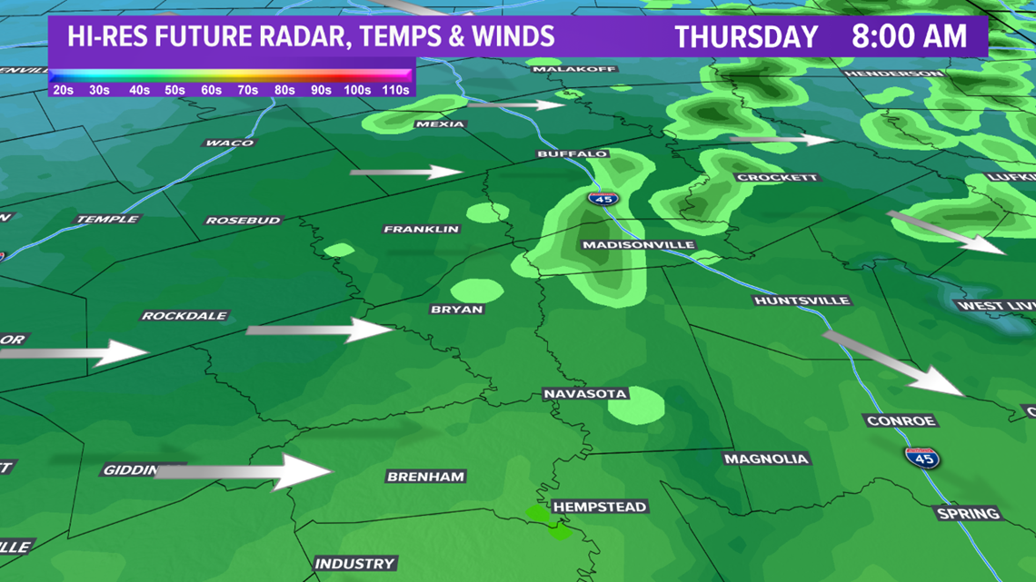
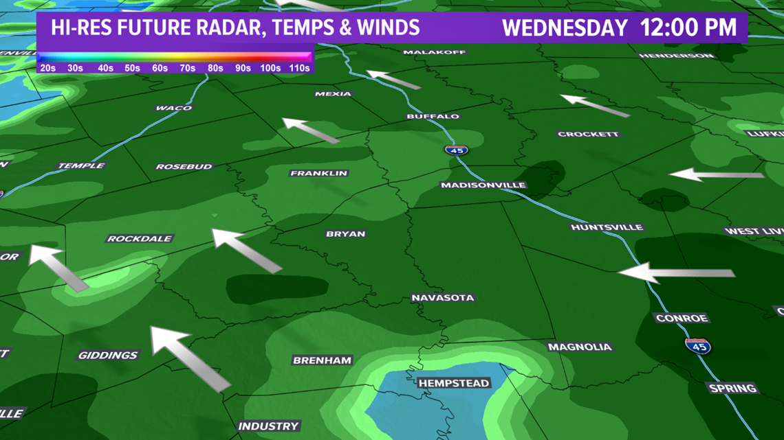
In the Brazos Valley, rain will continue throughout Wednesday. An uptick in "energy" is possible late Wednesday into early Thursday as another upper-level disturbance moves into Texas. This will allow for a brief opportunity to see isolated thunderstorms develop.


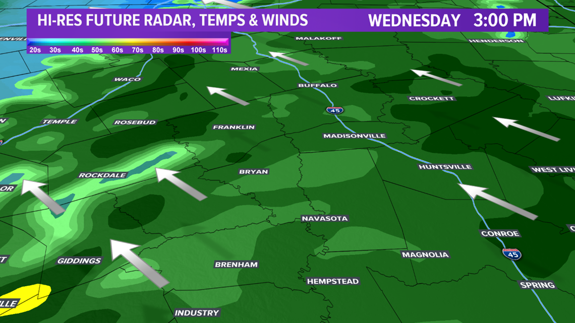

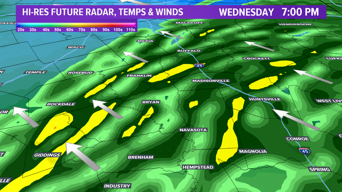

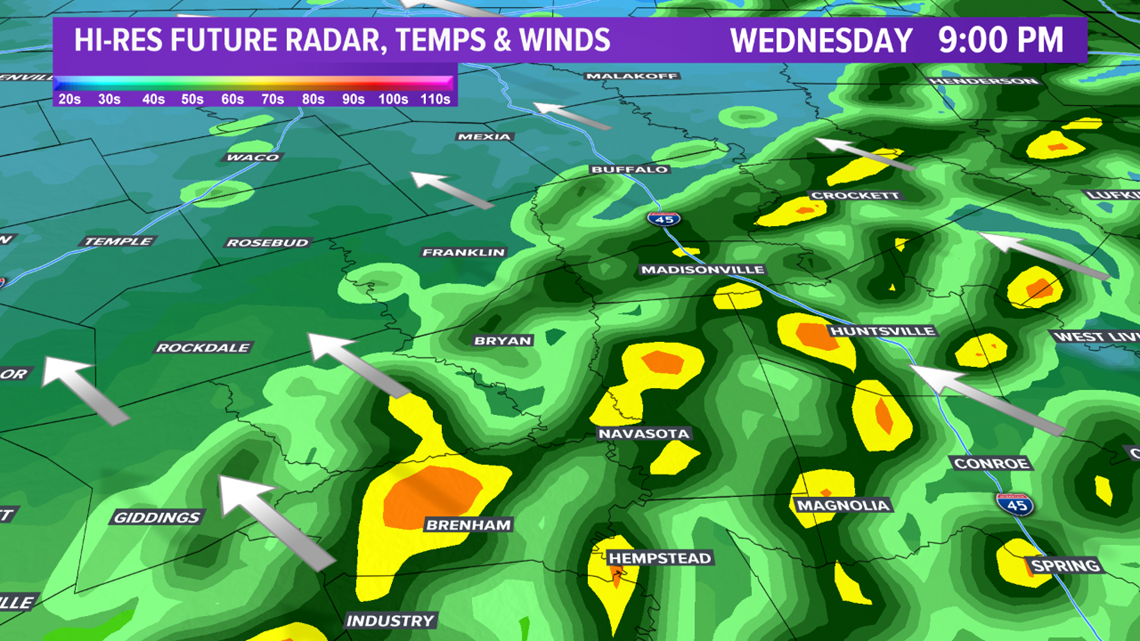
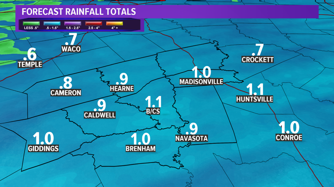
No severe weather is expected but brief heavy rain may fall. Flash flooding is limited in the Brazos Valley as most areas will receive 1" or less of rain. Farther south along the Texas Coast, heavier rain amounts are possible early Thursday, which may lead to localized flash flooding. A cold front will move through during the morning hours on Thursday, sweeping out the moisture to our south & east by lunchtime.

