TEXAS, USA — Severe thunderstorms and tornadoes are likely Friday afternoon and evening for Texas as a storm system moves out of the Southwest into the Southern Plains Friday.
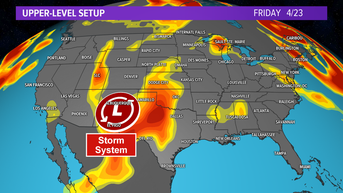
The storm system is currently moving across the Four Corners states and will continue to move southeast toward Texas over the next 24-hours. As the storm system approaches, the Canadian high pressure that delivered the cooler weather to the region will move east, allowing for a quick surge in warm and moist air north throughout Thursday and Friday.

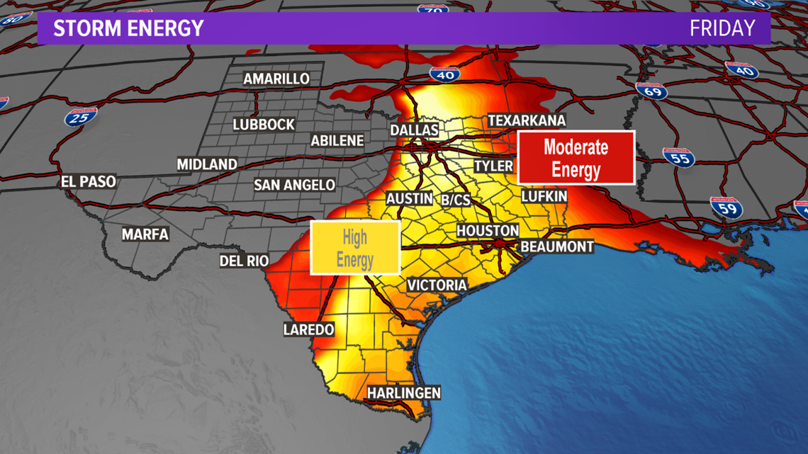
The return of this warm and moist air will create an unstable atmosphere for central, northern, southern and eastern Texas Friday afternoon through the evening hours. There are some questions regarding morning cloud cover and rain on Friday, which could act to lessen the instability, thus, decrease storm intensity late-Friday. Despite those questions, numerical guidance suggests the unstable airmass will have moderate to high storm energy. Moderate to high amounts of storm energy will act as the fuel to feed thunderstorms Friday afternoon and evening.

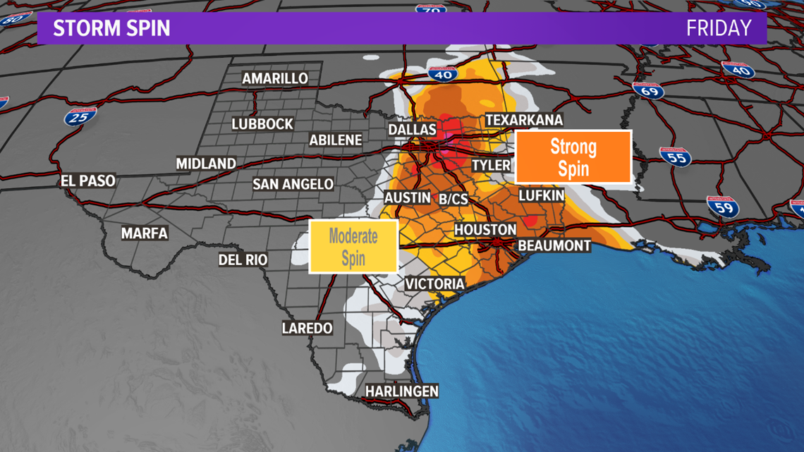
Paired with the moderate to high storm energy will be moderate to high storm spin as the storm system spreads favorable wind speeds and directions over the state. The storm spin will lead to storms becoming severe and allow for tornadoes where the storm spin and storm energy are highest. The highest storm spin will be along an approaching dryline, cold front and warm front in northern Texas as well as for areas along and east of I-35 in eastern and southern Texas.

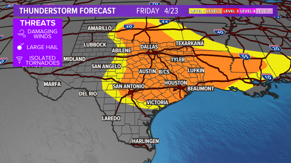
Due to the high storm energy and strong storm spin, there is a Level 2 severe risk for a good chunk of central, northern, southern and eastern Texas Friday afternoon and evening. Within the Level 2 severe risk area, tornadoes, wind and hail are all possible. An upgrade to a Level 3 severe risk is possible late-Thursday or Friday.

The forecast will continue to be fine-tuned over the next 24-hours.


