BRYAN, Texas — 12:26 p.m.
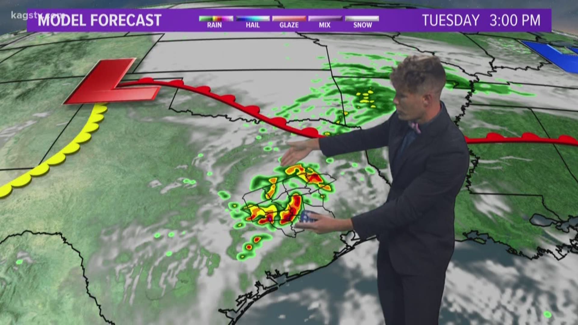
TORNADO WARNING: Burleson County is now included in the tornado warning from the National Weather Service. This storm is expected to hit Deanville, Caldwell, Cooks Point and Hix within the next hour. Seek shelter immediately. This storm has a history of producing tornadoes, including one near Upton.
11:27 a.m.
TORNADO WARNING: Tornado indicated northwest of Giddings. Lee and Bastrop Counties are under Tornado warnings. Dr. Christopher Nunley said this is some of the strongest rotation that can be seen on radar at this time.
This is a dangerous storm. It is moving to the northeast at about 20mph. If you are in the path of this storm, take your tornado precautions!
UPDATE: May 12, 2020 11:17 a.m.
Confirmed tornado on the ground near Smithville, working its way towards the northeast at about 20 mph. Dr. Christopher Nunley says this is one of the strongest storms showing rotation on radar. Storm spotters did see a confirmed tornado on the ground.
Previous Story:
Several opportunities for isolated to scattered storms are possible across the Brazos Valley this week into the weekend. The first opportunity arrives on Tuesday as an upper-level disturbance moves into Texas. This will send a weakening complex of storms into central Texas early-Tuesday morning. This complex of storms should move into the Brazos Valley but be losing its punch Tuesday morning. A second round of storms may fire up Tuesday afternoon, once we add in a touch of daytime heating, via an outflow boundary from the morning storms.
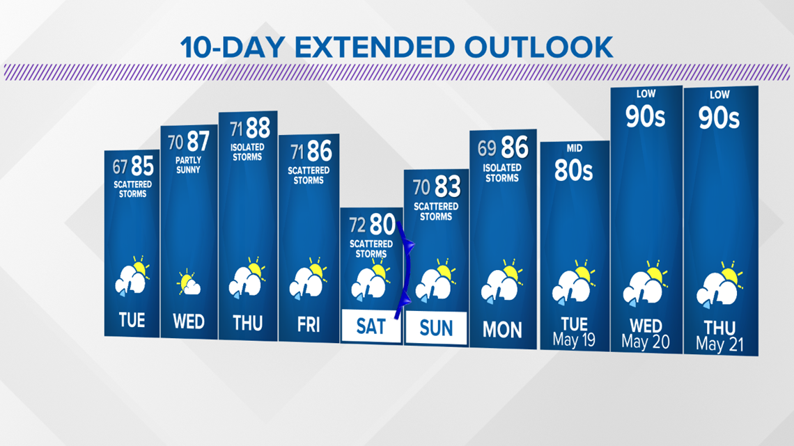
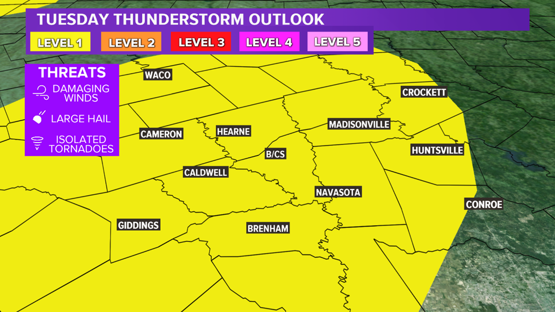
The evolution of the storms is still questionable and will play an impact on afternoon temperatures. Highs should climb at least into the low-80s; mid-80s are possible if thunderstorm coverage is less. With temperatures climbing into the 80s, he atmosphere will be fairly juicy so a severe storm cannot be ruled out. There is a Level 1 risk of severe storms across the Brazos Valley; main hazards are gusty winds and hail.

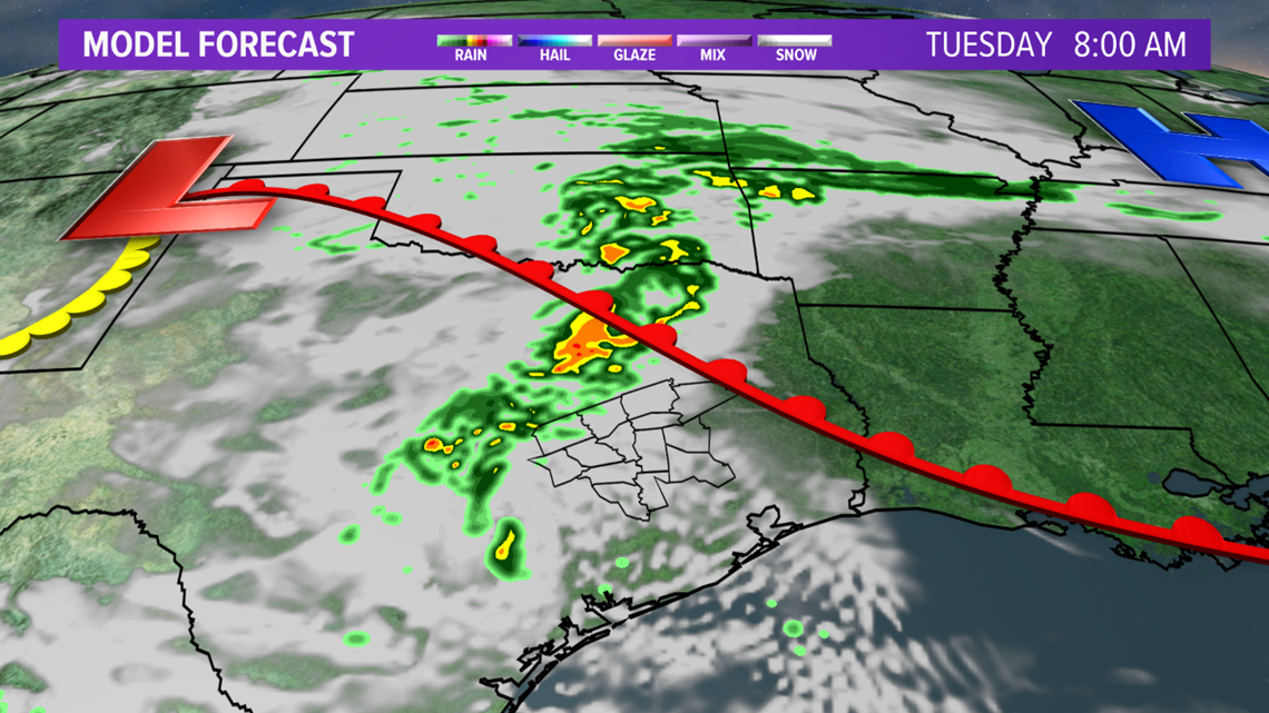

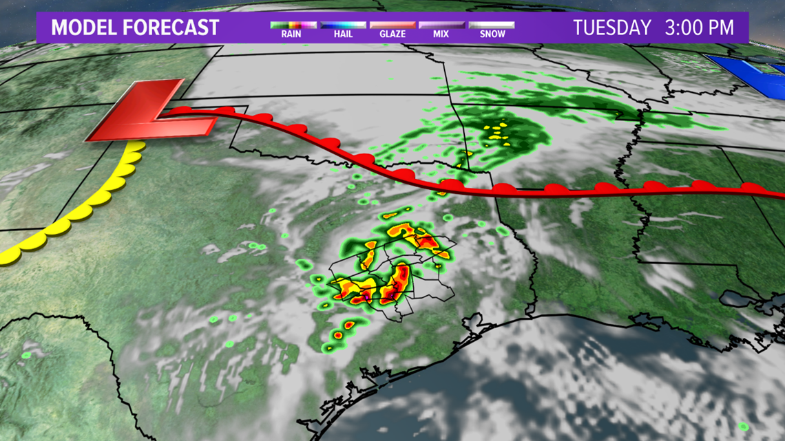

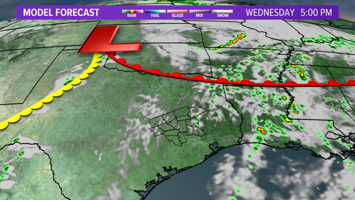
Tuesday's thunderstorm evolution will play a role on Wednesday's activity. Tuesday's storms may leave an outflow boundary somewhere across the Brazos Valley. This outflow boundary may be the focal point for thunderstorms Wednesday afternoon, with a touch of daytime heating, but most areas should remain dry unless the outflow boundary is well-defined.

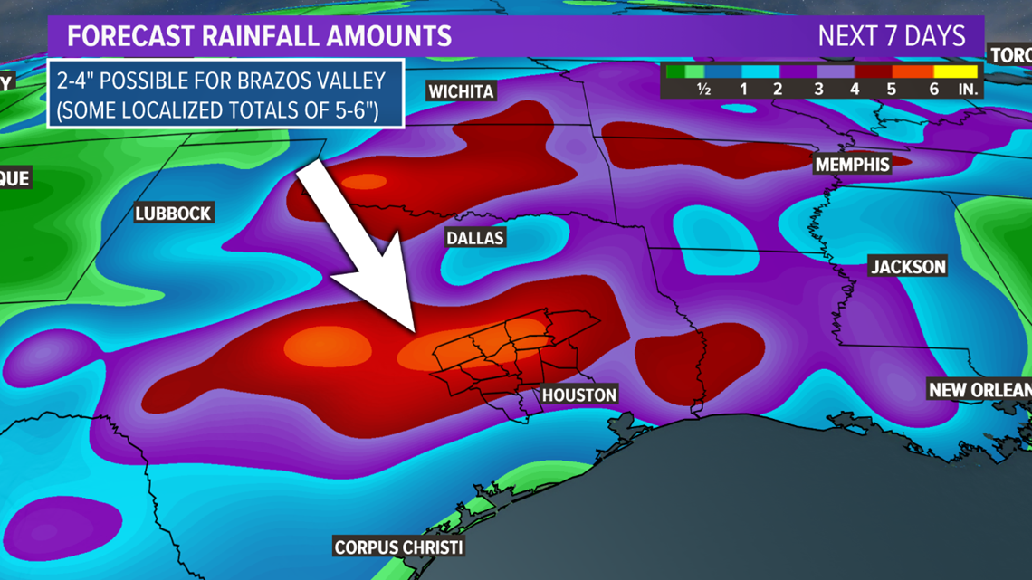
Better rain chances arrive Friday into the weekend as a potent upper-level storm system arrives from the west. This will trigger widespread thunderstorms across the Brazos Valley. A few of these storms may be severe. Over the next 7-day, the area may see 2-4" of rain with isolated 5-6" amounts--most of this rain will fall from Friday through the weekend.

