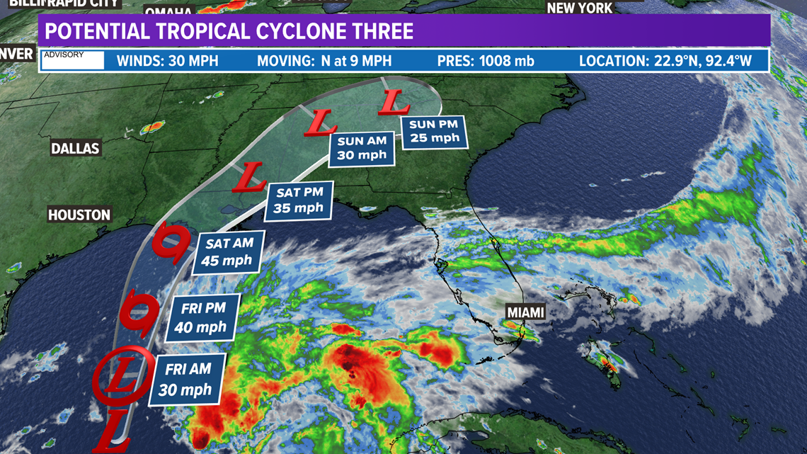
TEXAS, USA — Potential Tropical Cyclone Three developed in the Gulf of Mexico Thursday afternoon. PTC3 has winds of 30 mph and is moving north at 9 mph. The current forecast moves PTC3 into Louisiana early-Saturday as Tropical Storm Claudette with winds of 45 mph.


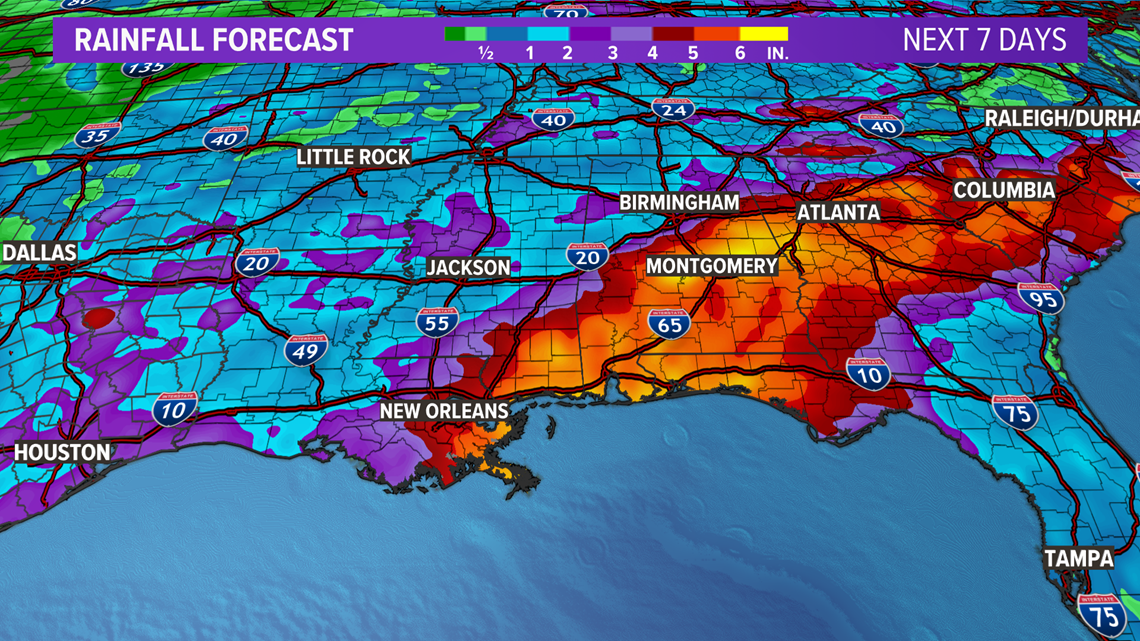
Regardless of track and intensity, the main impact from this tropical system is heavy rain east of the center of Tropical Storm Claudette. The heaviest rain will fall in southeastern Louisiana, southern Mississippi, southern and central Alabama, the Florida Panhandle, Georgia, and the Carolinas. 3-6" of rain can be expected for these areas leading to areas of flash flooding.


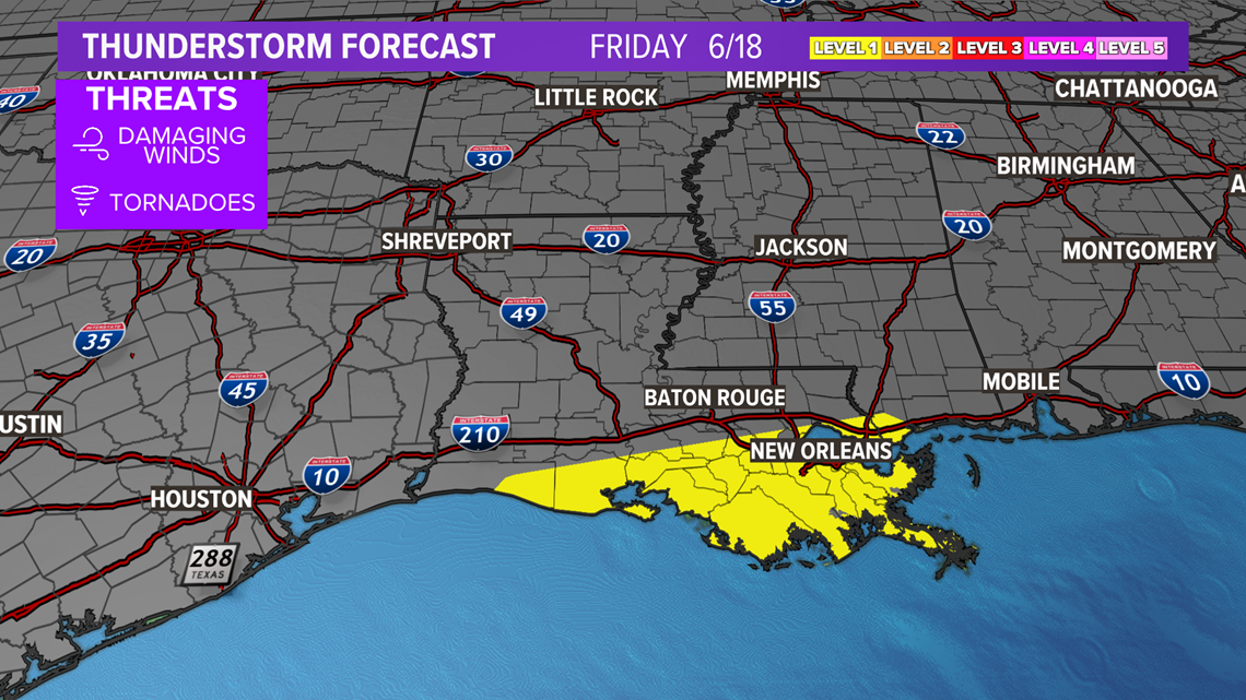
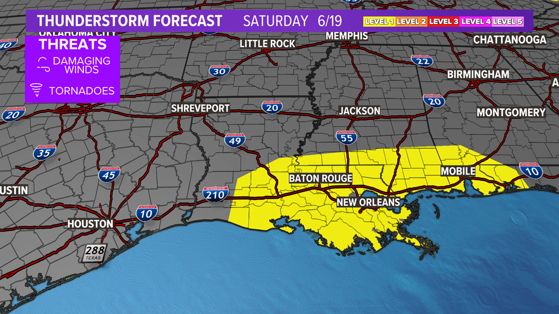
A low-end tornado threat is forecast for these areas as Tropical Storm Claudette approaches the northern Gulf coast Friday and makes landfall Saturday. The tornado threat Friday will be confined to southern Louisiana and coastal Mississippi, but spread farther inland Saturday as Tropical Storm Claudette makes landfall. The highest tornado threat will exist for southern Louisiana, southern Mississippi, southern Alabama, and the Florida Panhandle.


Impacts in Texas are forecast to be minimal with the current forecast track. A few showers are forecast in southeastern Texas with wind gusts up to 35 mph. Seas will be rough with rip currents for Texas beaches so follow all guidance by local officials.


