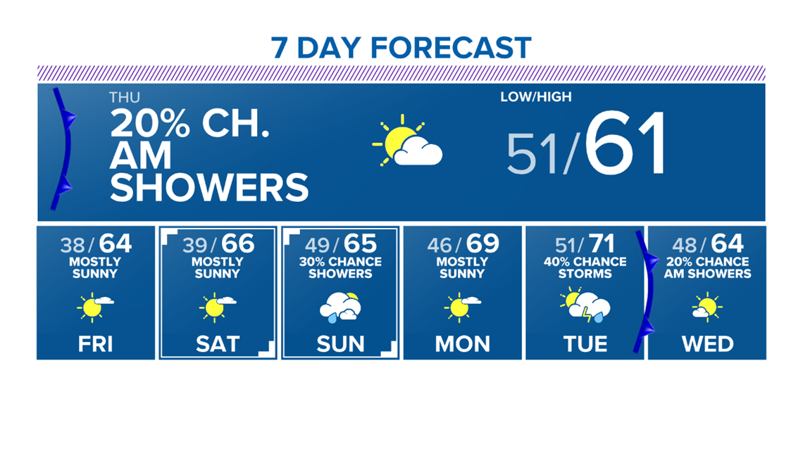
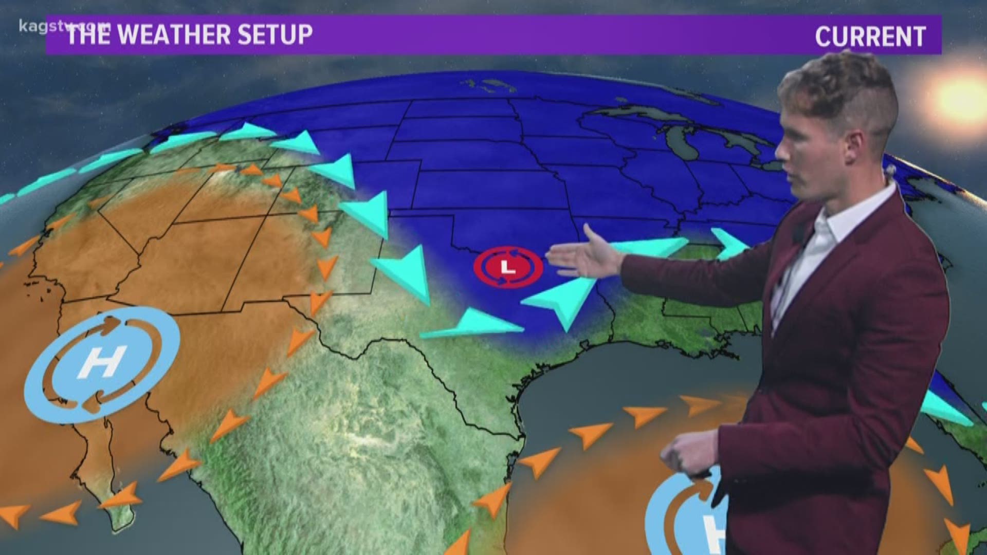
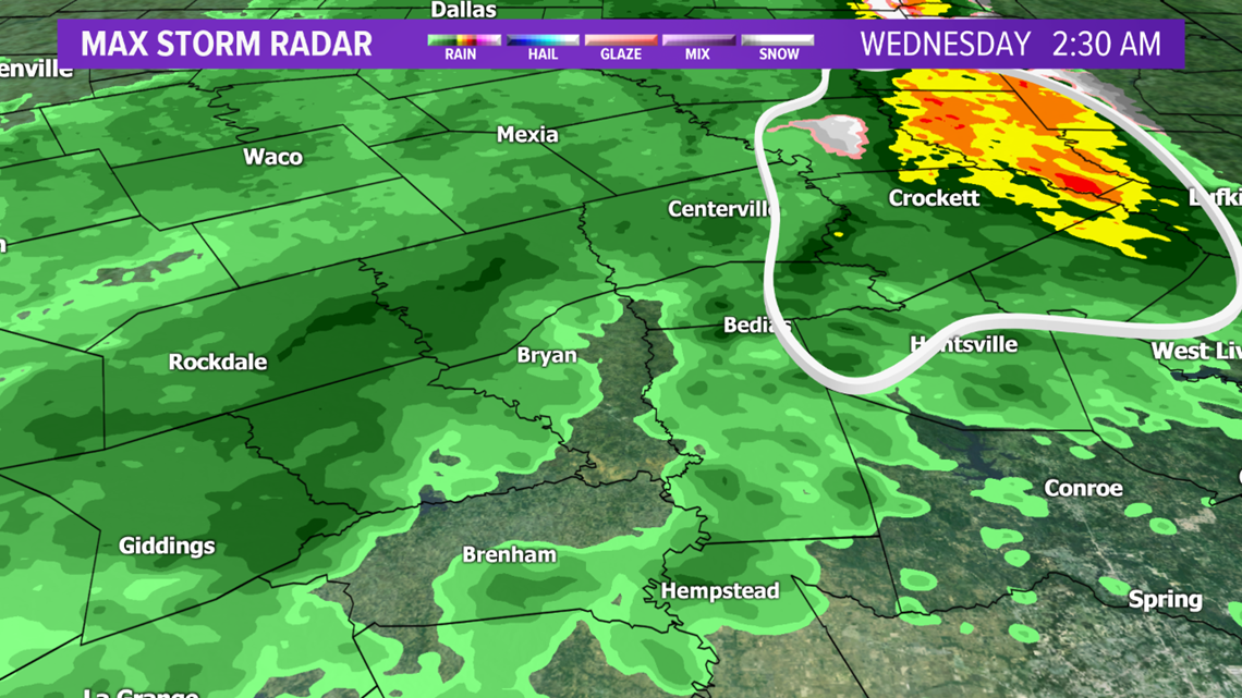
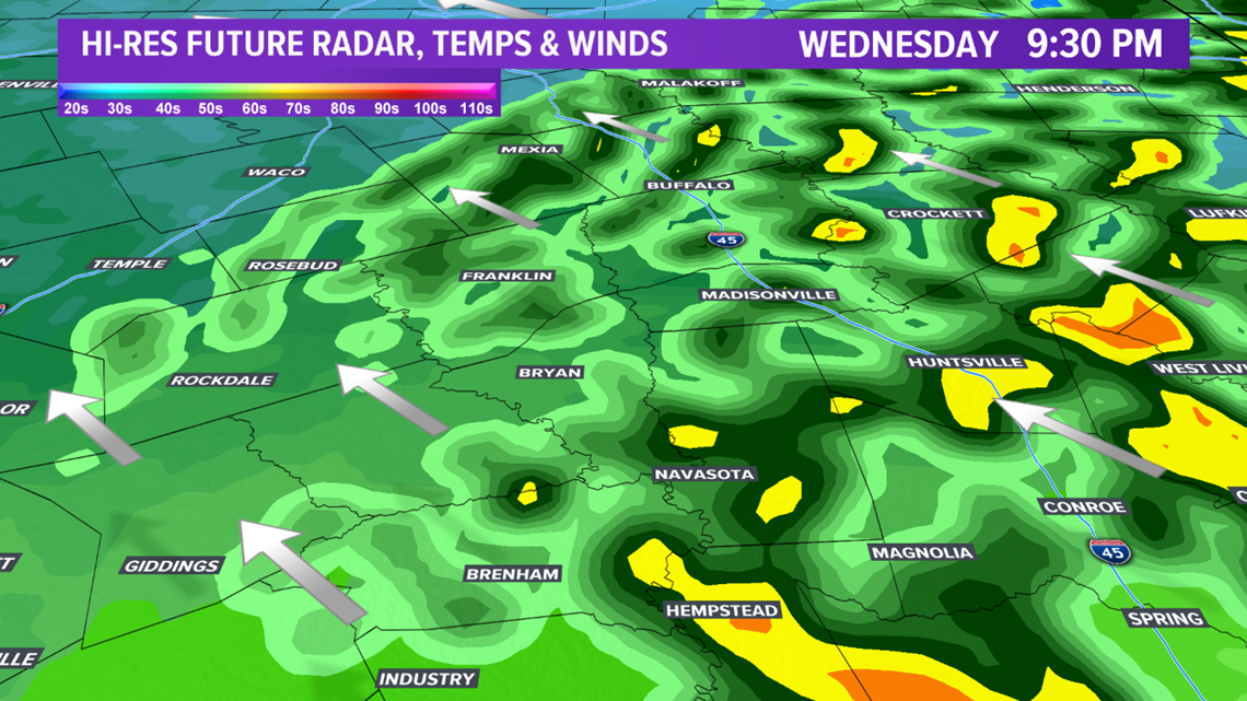
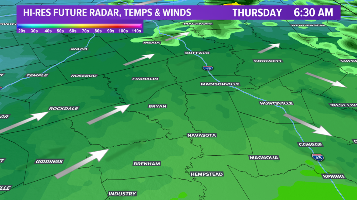
Early Wednesday morning, light wintry precipitation was observed across the northeastern zone of the Brazos Valley. Radar confirms this, which is indicated by the bright colors (yellow, orange & red) on radar. The sleet & snow quickly transitioned to rain as temperatures warmed. Showers & isolated storms expected to continue into the evening hours Wednesday. No severe weather is in the forecast but locally heavy rainfall is possible with any storm that develops. Temperatures are on the cool side but safely remain above freezing. Rain showers will gradually decrease in coverage after midnight. By Thursday morning, only very isolated showers possible.


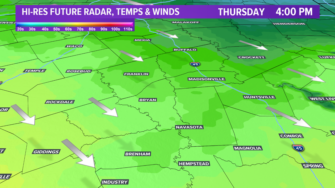
The drying trend will continue Thursday afternoon. The sun should make a return after lunchtime. Temperatures will remain on the cool side due to a cold front. Highs will struggle to get into the low-60s.

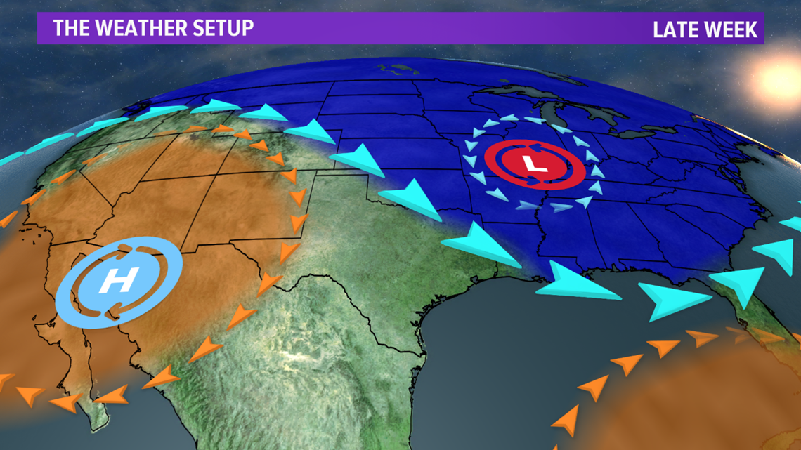
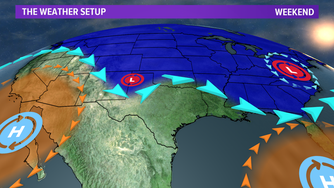
Temperatures will remain on the cool side to end the week but we will remain dry. Heading into late-weekend, a disturbance will dive southeast into Texas. At the same time a weak disturbance will move northeast out of Mexico. These two features will act to create an uptick in cloud cover & moisture across eastern Texas, including the Brazos Valley. Isolated showers are possible Sunday.