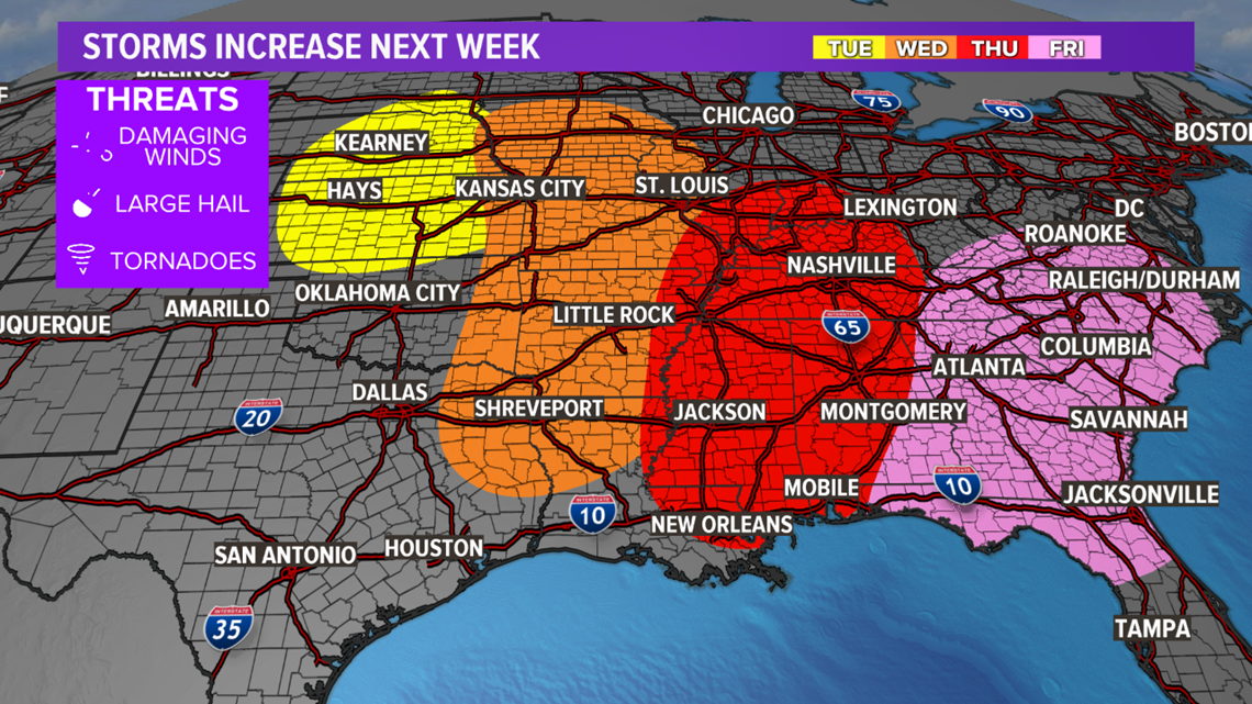
TEXAS, USA — A multiple-day thunderstorm event is expected next week as a slow-moving storm system moves across the lower-48.
Ahead of the storm system, warm and moist air will surge north. This air mass will be the fuel needed to support thunderstorm development as a cold front surges into the unstable air. Paired with the unstable environment ahead of the cold front, will be favorable shear profiles provided by the storm system.
The favorable shear will help support and maintain vigorous thunderstorms that may become severe. The thunderstorm and severe threat begins Tuesday across the central Plains where hail and wind are possible. The thunderstorm and severe threat will shift farther south and east from mid-week through late week, eventually reaching the eastern seaboard by Friday. The wind and hail threat will continue through the week with increased tornado potential from mid to late week.


There is still uncertainty with the specifics of this setup but the picture will become clearer over the coming days. Go ahead and prepare for severe thunderstorms next week if you're in or near the highlighted areas. Make sure you have a plan in place in case a warning is issued for your area and have a few reliable sources to receive weather information.


