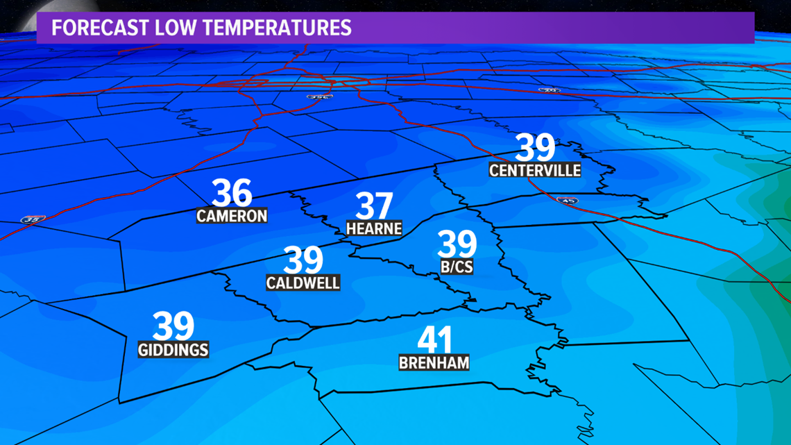
BRYAN, Texas — A cold front will move south across the Brazos Valley Monday night. A surface high will build in behind the cold front, which will drop Tuesday morning temperatures into the 30s. A jacket will be needed as you step out of the door Tuesday. The jacket won't be needed Tuesday afternoon. Temperatures will climb into the low-60s for highs under mostly sunny skies.


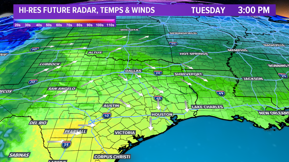
Temperatures will continue to warm into mid-week. Moisture will also begin to increase as the surface high scoots to the east. This will flip the wind around to the southeast allowing the moisture transport to continue for the Brazos Valley into late week.

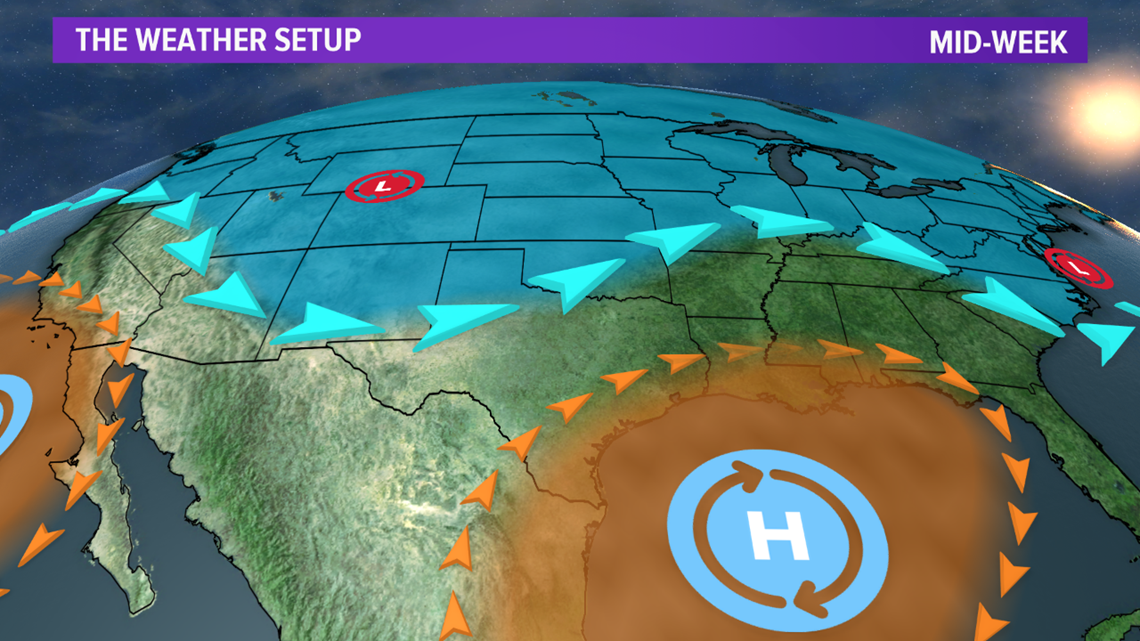
The return of moisture will set the stage for thunderstorms Thursday and Friday. Thursday's storms will be isolated in nature and are not expected to become severe. The recipe for severe storms will reside to the west of the Brazos Valley on Thursday. The first ingredient is a deep upper-level trough, which will move into Texas on Friday.

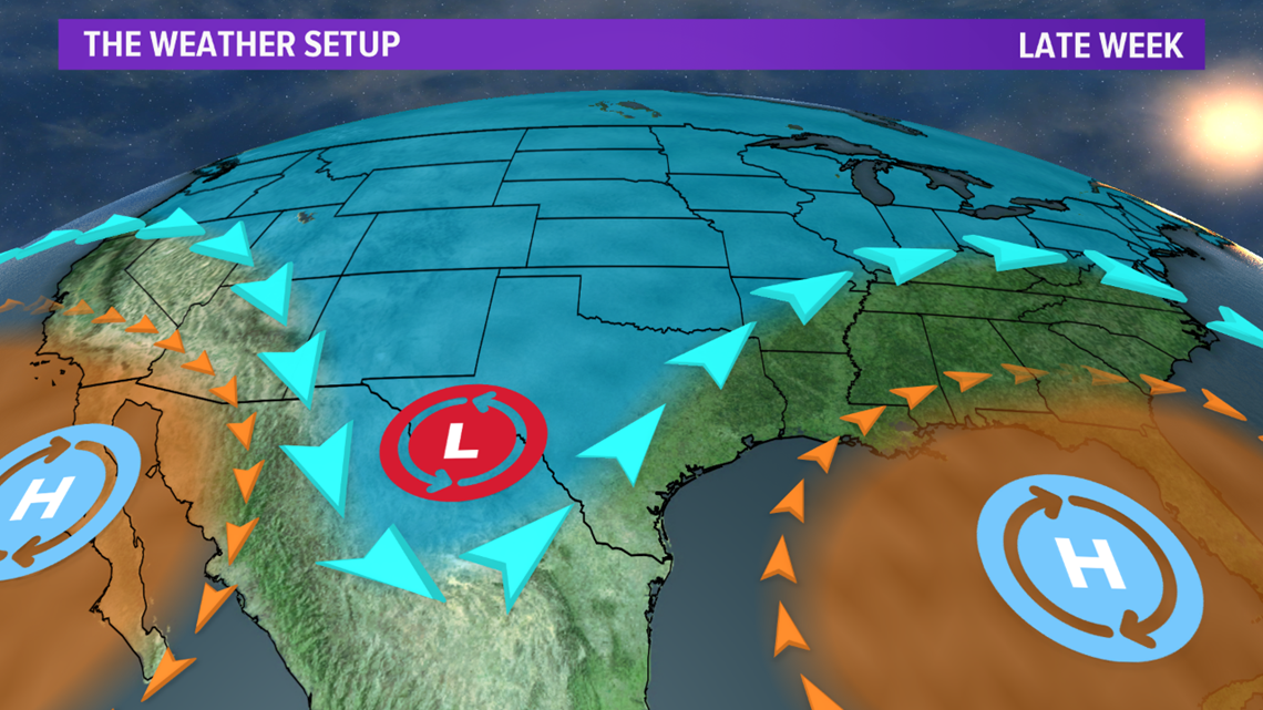
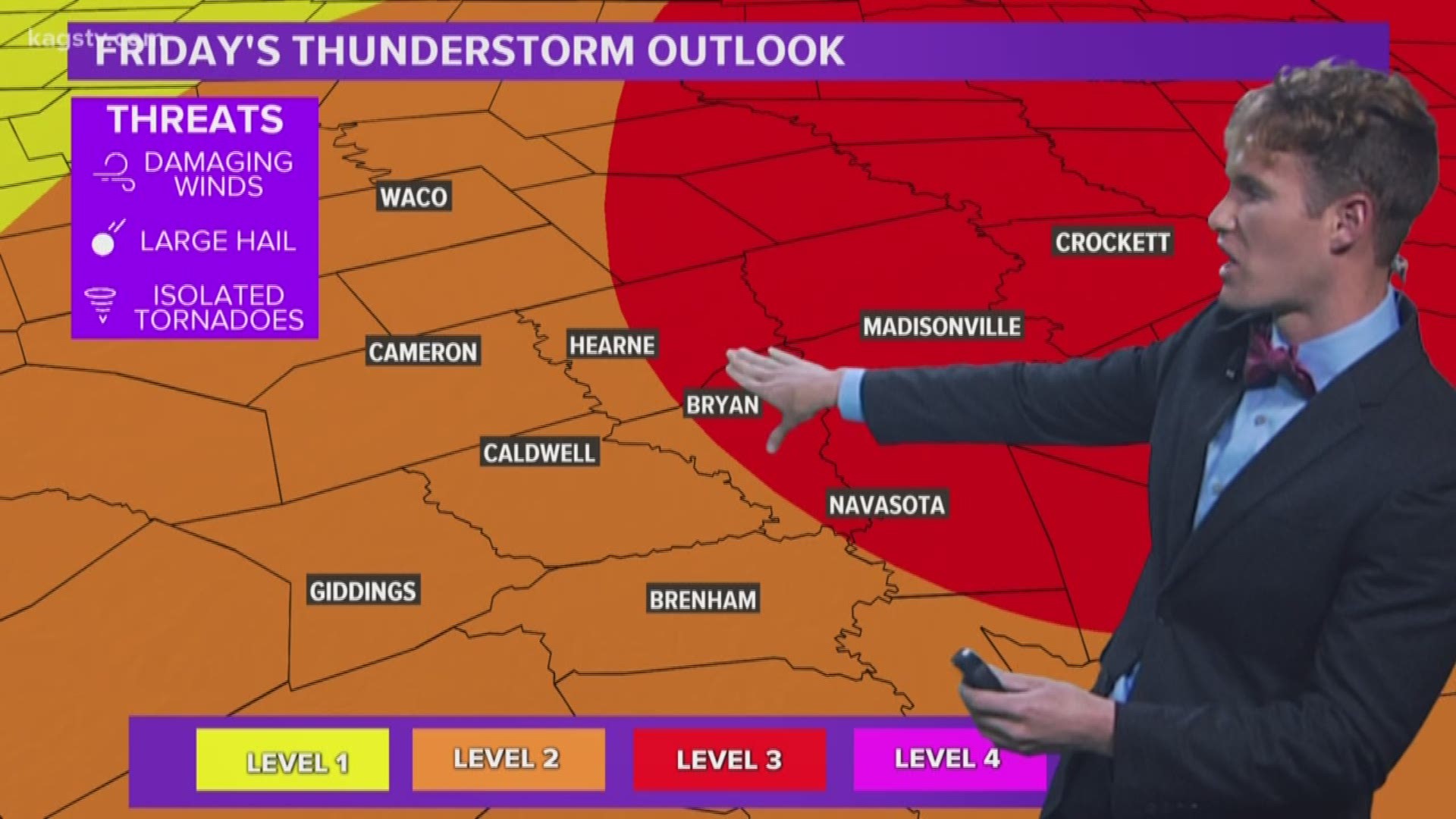
This trough will have very strong winds aloft that will move over-top of the area late in the day on Friday. At the same time, the second ingredient (cold front) will move south into northwestern parts of the Brazos Valley late Friday evening. This cold front will help trigger thunderstorms thanks to the final ingredient (warm & moist air) that will be in place. All of these ingredients will allow for strong to severe storm chances increasing Friday evening into the overnight hours on Friday. It appears tornadoes, damaging winds & large hail are all possible. There is a level-3 severe risk for a large part of the Brazos Valley Friday. It is possible this may be upgraded to a level-4 risk over time if confidence continues to increase that high-impact thunderstorms will develop over the area.

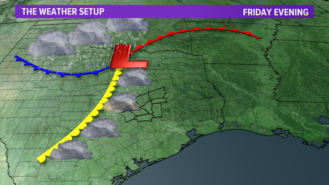

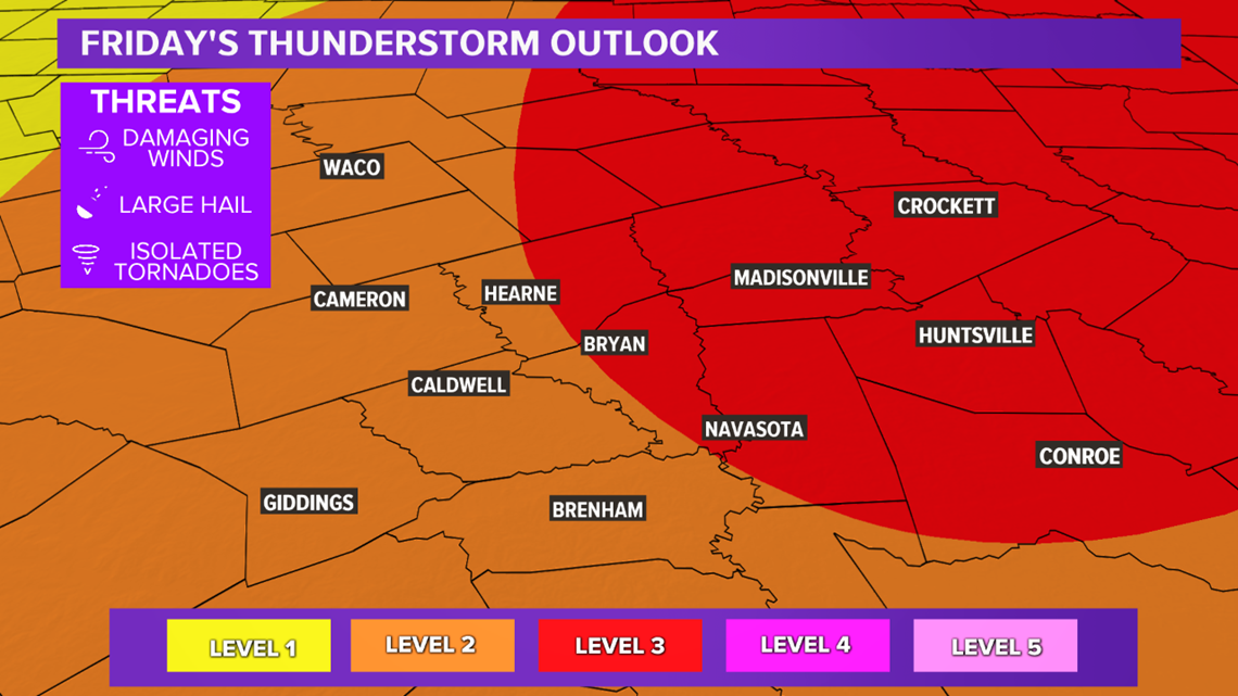
There are still questions regarding this setup. The event is several days out so a lot can change but there is growing confidence of severe thunderstorms in/or near the Brazos Valley. Keep in mind, if we start lacking ingredients for severe storms, the level-3 risk may be downgraded. Keep check back for updates.

