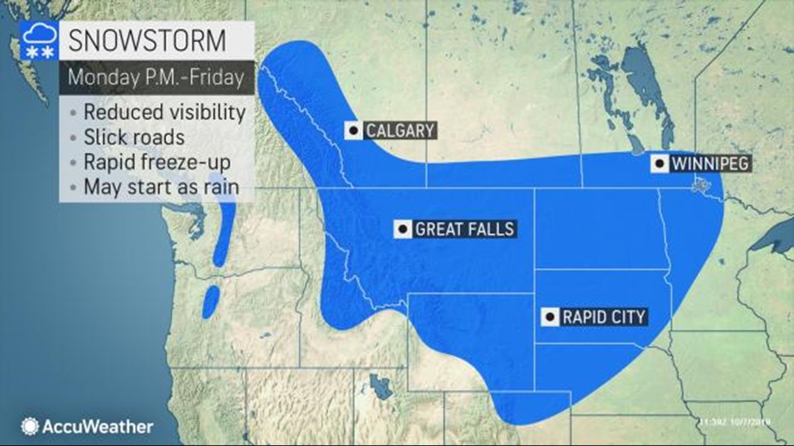
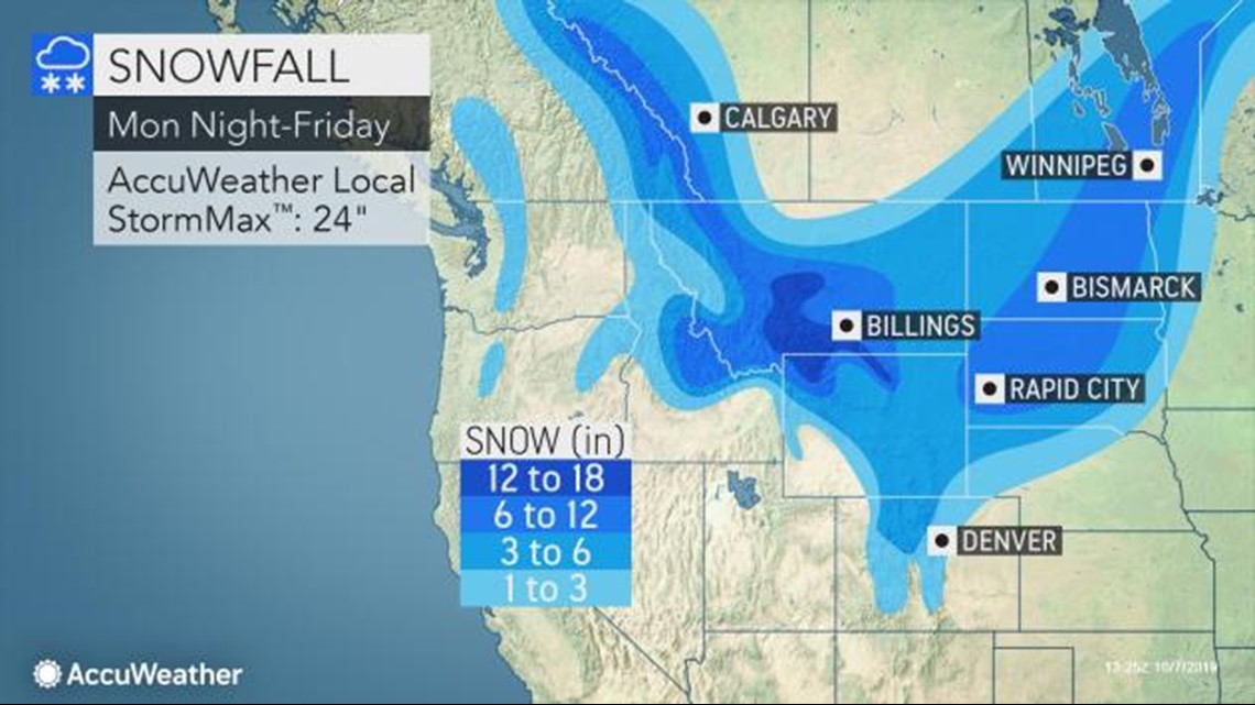
BRYAN, Texas — A high-impact winter storm dump snow across the central & northern Rockies and much of the north-central United States beginning Tuesday and continuing into the weekend. The local National Weather Service offices have issued Winter Storm Watches, Winter Weather Advisories & Winter Storm Warnings for parts of Montana, far northeast Idaho, northern Wyoming, far northwestern Nebraska and western South Dakota for the threat of heavy snow. It is likely additional winter weather alerts (Watches, Advisories & Warnings) will be issued over the next 12-36 hours.


Snow will begin across the northern Rockies on Tuesday before slowly shifting south and east on Wednesday into the western North & South Dakota and much of Wyoming. The snow will continue spreading south and east on Thursday into much of Colorado, far northwestern Kansas, western Nebraska and advance into the central Dakotas. The Denver Metro will see its first snow of the season with accumulations likely.
By late Thursday night into Friday, it is possible light snow may extend as far south as northeast New Mexico and the Oklahoma & Texas Panhandles (rain/snow mix). Continuing through Friday into Saturday, the snow will advance into eastern North & South Dakota, Minnesota and western Iowa.
Moderate to heavy accumulations are likely for much of the northern & central Rockies as well as north-central parts of the United States. It is too early to determine specific snow amounts but travel issues can be expected from Colorado north into Wyoming and Montana as well as into the Dakotas.


This same storm system will send a strong cold front south into the Brazos Valley on Friday. This cold front will pack the coldest air of the season. High temperatures will stay in the 70s for both Friday and Saturday with lows falling into the upper-40s for the northern Brazos Valley. Tune into KAGS at 6 & 10PM for the latest details.


