BRYAN, Texas — Hurricane Laura
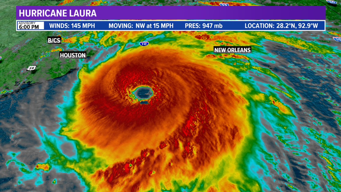
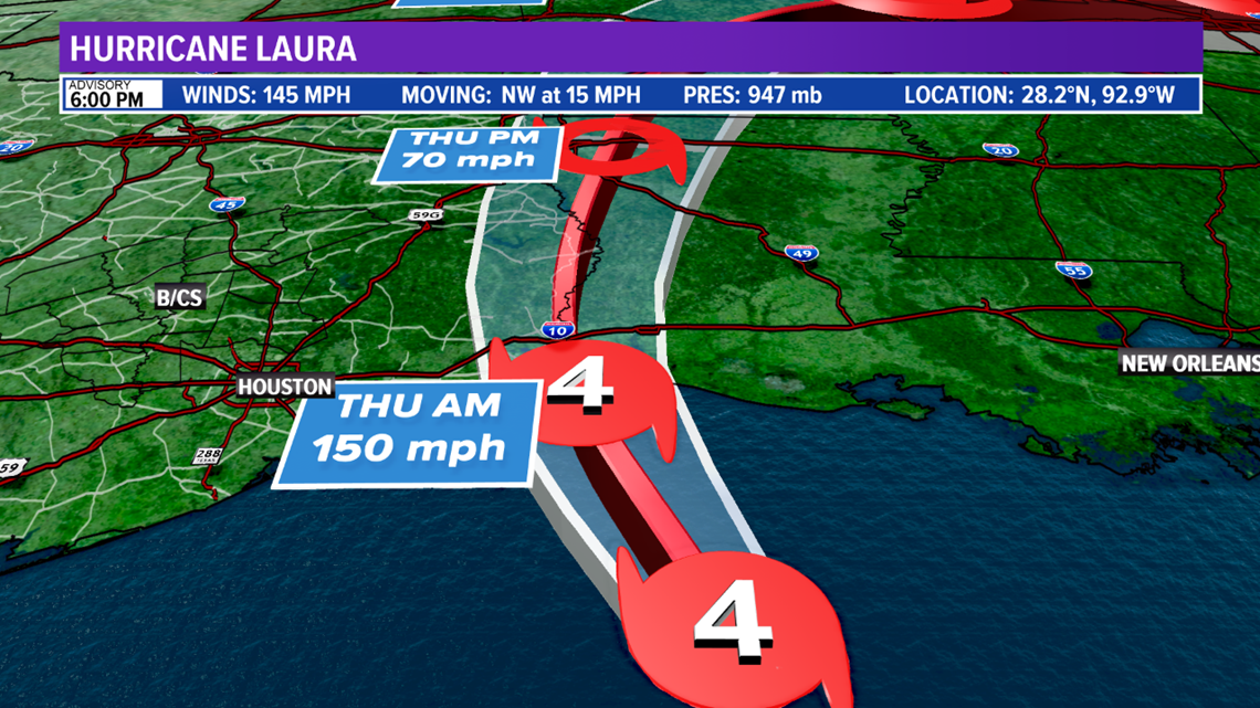
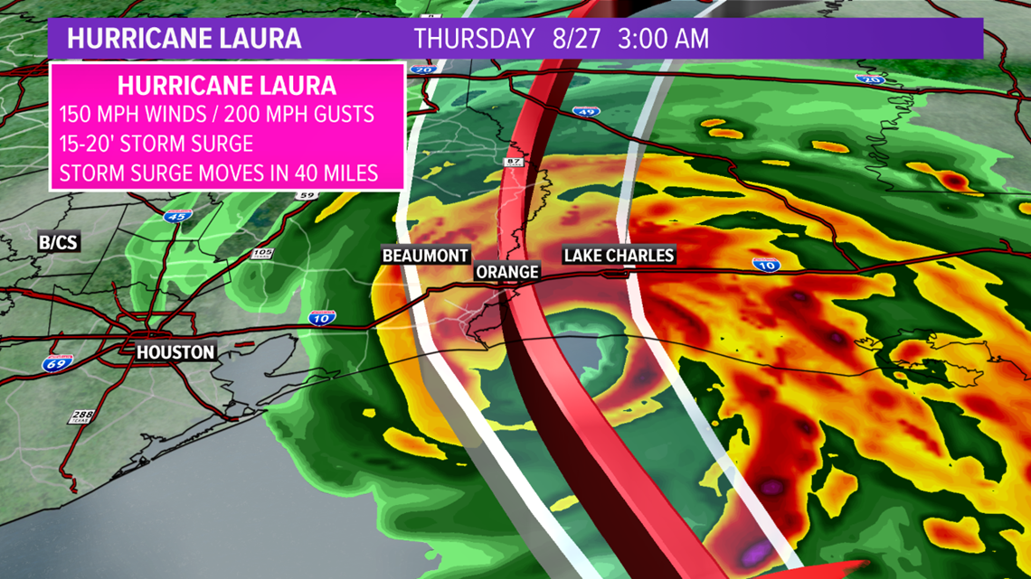
People in the Brazos Valley and along the upper-Texas coast are keeping a close eye on Hurricane Laura. Laura is moving across the warm Gulf of Mexico and has intensified into a strong Category 4 Hurricane. Winds are sustained at 145 mph. Further strengthening is likely before landfall near the Texas/Louisiana border very early Thursday morning.



Brazos Valley Impacts
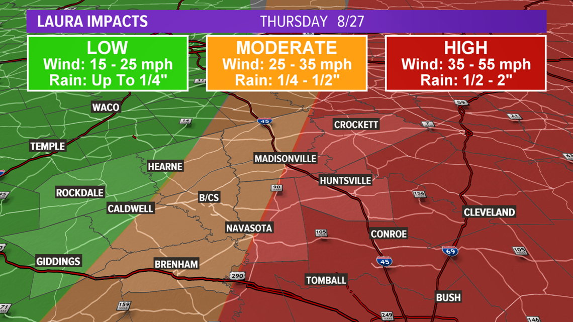
The track east of the Brazos Valley will keep most of the impacts east of the area. However, Laura is a large system so there will be impacts. Showers and storms are possible with the best chance towards the I-45 corridor. This is also where the highest chance for Tropical Storm Force Winds (39+ mph) exists. The flooding and tornado threat are low.

Coastal Texas Impacts
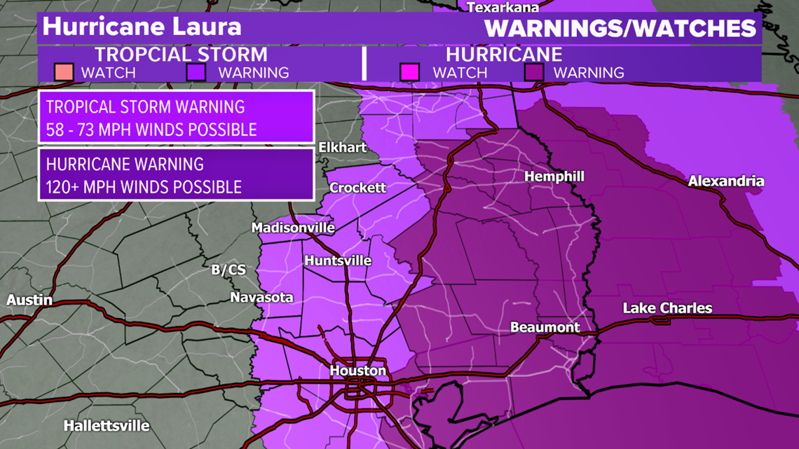
Towards coastal-Texas and coastal-Louisiana, more significant impacts are likely. Laura may produce winds in excess of 100 mph, induce a several feet storm surge (coastal areas), heavy rain & flooding and tornadoes. A Tropical Warning is in place for the eastern-half of the Brazos Valley. This means Tropical Storm conditions are possible within the Warning area within the next 36-hours. A Hurricane Warning is in place farther south towards coastal Texas.

Keep checking back for updates as there is still some uncertainty in this forecast!


