BRYAN, Texas — Abnormally warm & moist conditions remain across the Brazos Valley ahead of a strong storm system that will move through Wednesday. The southerly flow is continuing to pump in Gulf moisture Tuesday morning, which has allowed a few areas of fog to develop. Temperatures are in the mid-60s.

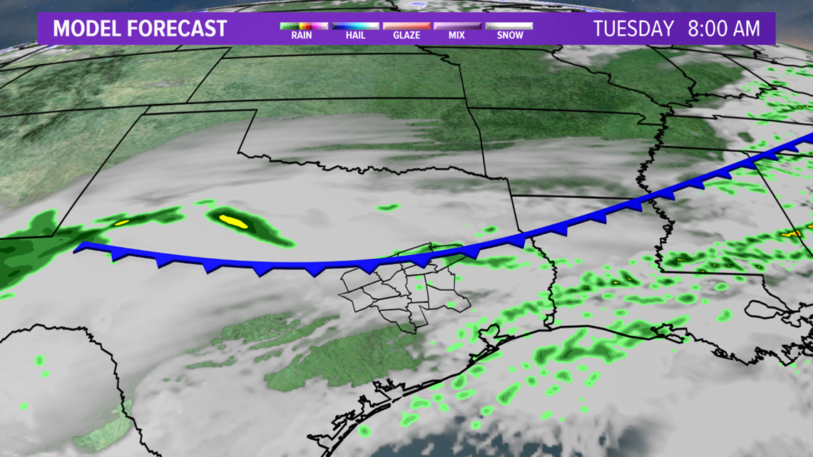

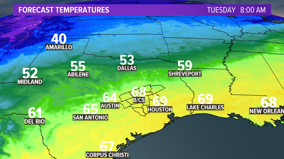
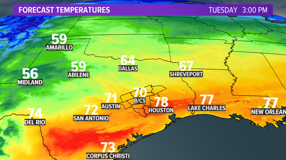
The well-advertised storm system to our west continues to slow as it spins over the Baja of California. The slowing of this storm system will keep the majority of Tuesday dry. There will be an opportunity for isolated showers across the northern zone on Tuesday as weak cold front stalls in the vicinity. Temperatures will flirt with 80 across the southern zone Tuesday afternoon.

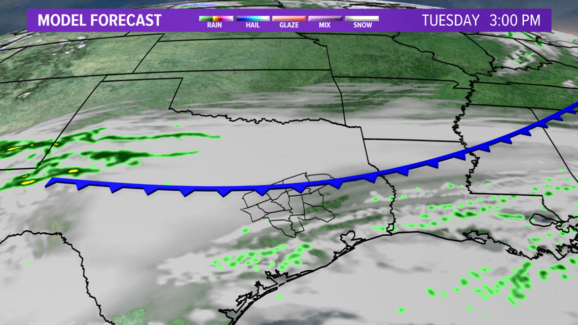

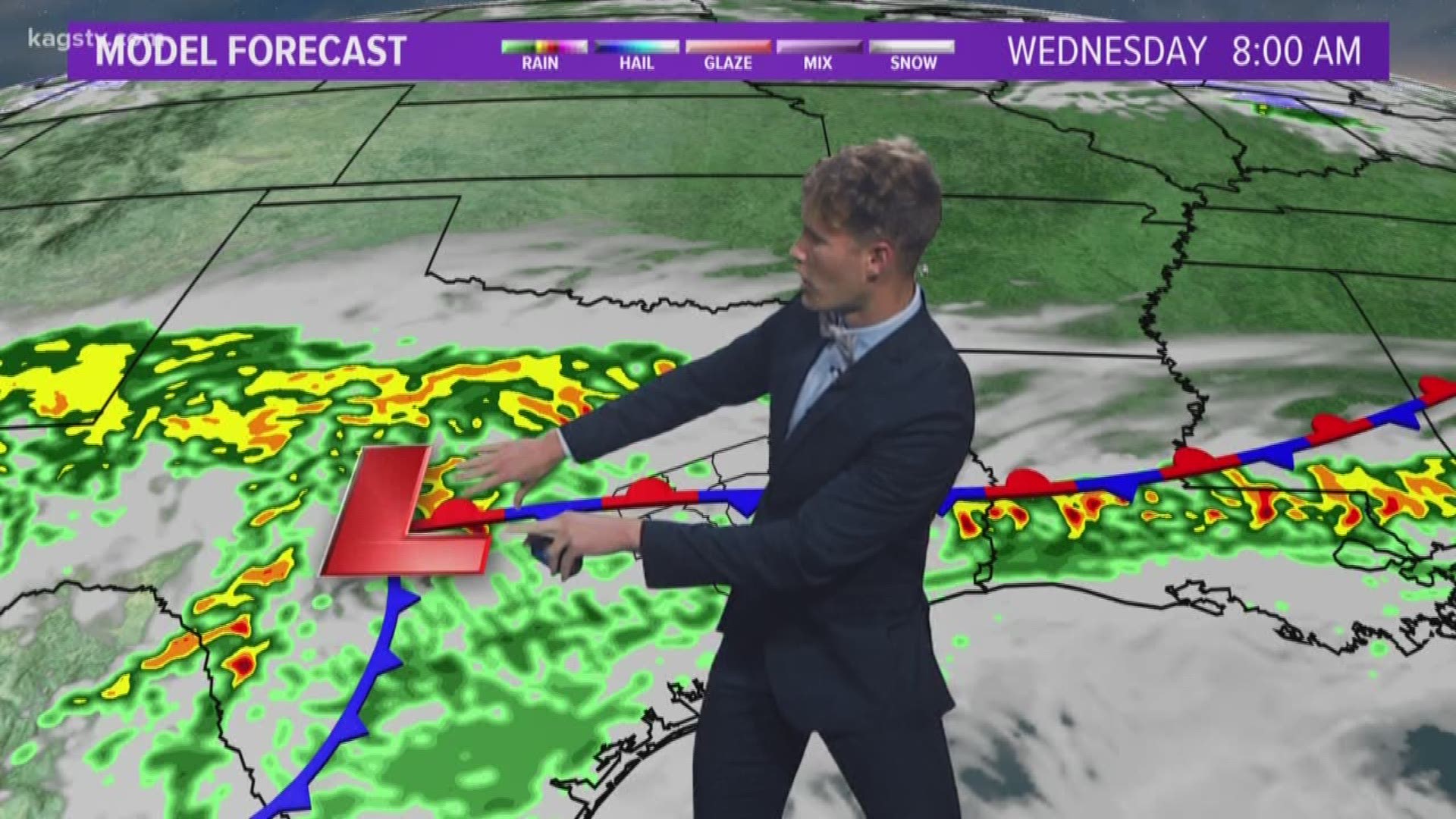
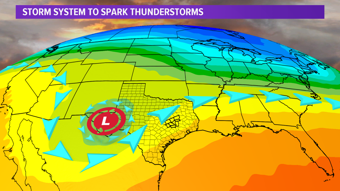
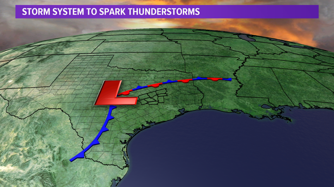
The upper-level storm system will move into western Texas overnight Tuesday. This will allow a surface low to develop to the southwest of the Brazos Valley overnight Tuesday. The development of the surface low along with strong lift from the upper-level storm system will generate thunderstorms across the Texas Hill Country. A few of these storms will become severe late-Tuesday. The storms will slowly move east overnight Tuesday into Wednesday morning. The heaviest thunderstorm activity will impact the Brazos Valley Wednesday morning, possibly extending into the early afternoon hours, depending on the speed of the low pressure.



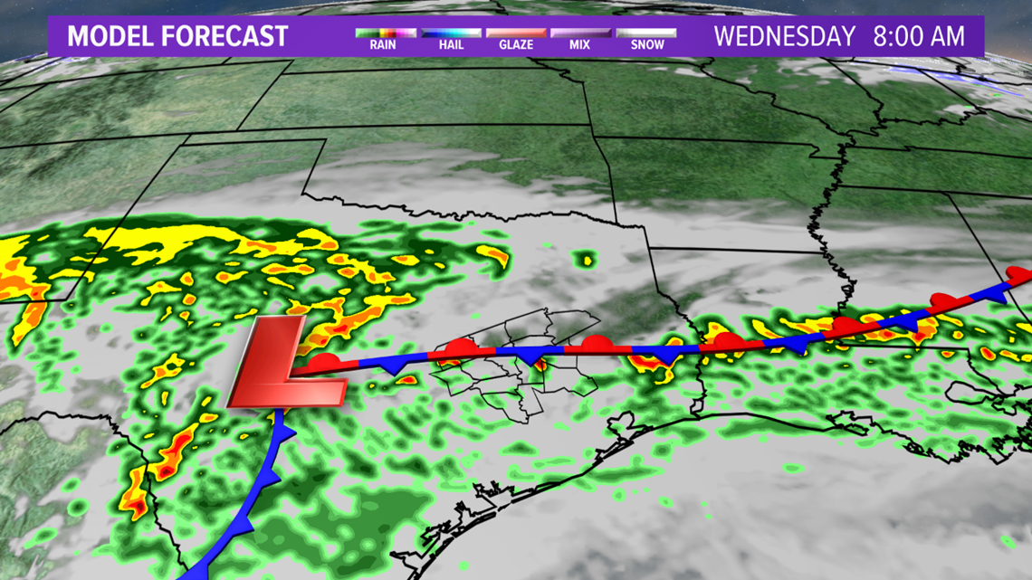

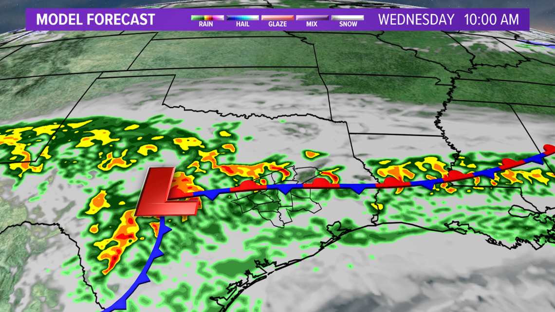

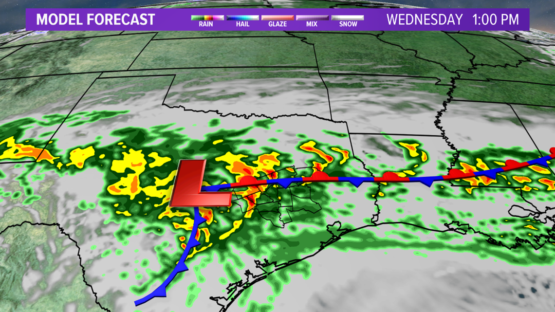
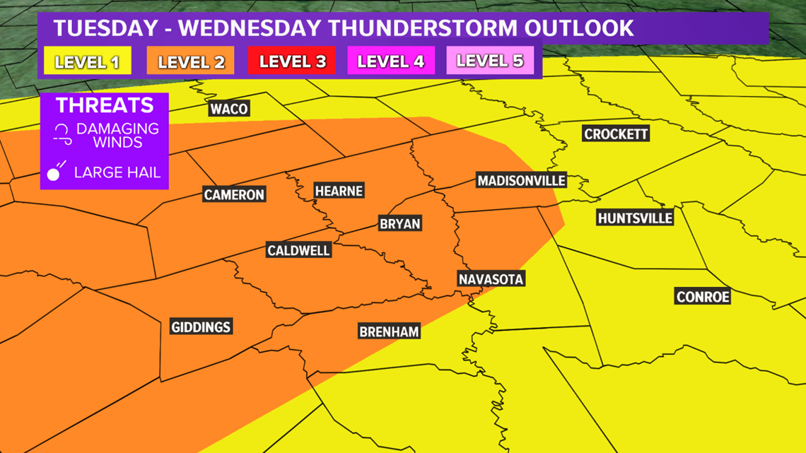
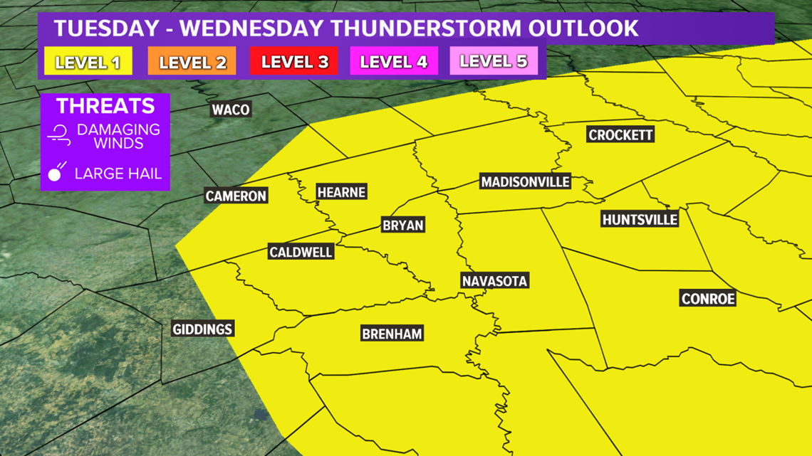
The Storm Prediction Center much of the Brazos Valley in a Level 1 category for severe storms late-Tuesday with a Level 2 risk for the central & western zone. The main risk is expected overnight Tuesday continuing into Wednesday with the best time-frame being from 6:00 am-1:00 pm Wednesday. The Storm Prediction Center has a Level 1 risk for severe storms across the area Wednesday. The main hazard is damaging wind but large hail and an isolated tornado cannot be ruled out, especially if the system continues to slow. This will be monitored over the next 12-24 hours. It is possible the thunderstorm outlook maps will greatly change over the next 24 hours so keep check back for updates.


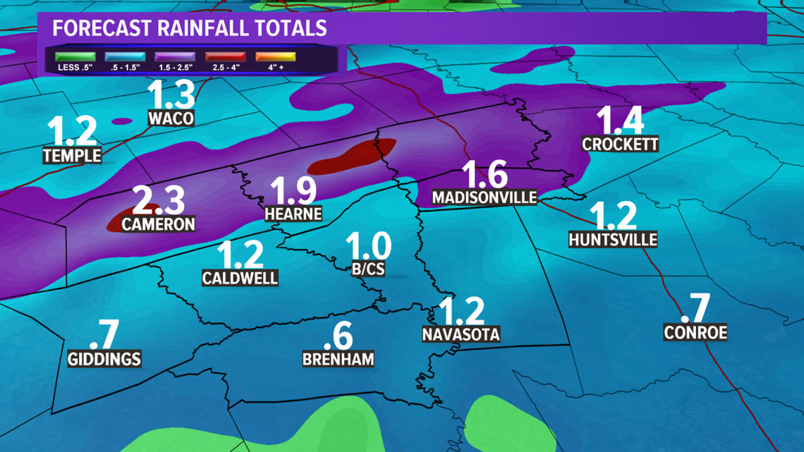
Heavy rain will also fall with the showers & thunderstorms from overnight Tuesday through all of Wednesday. Rain chances will continue through the entire day Wednesday as the upper-level storm system generates enough lift to continue rain chances. The heaviest rain axis will be across the northern zone near the stalled frontal boundary. 2-3" are possible across the northern zone with the southern zone receiving less than 1".

