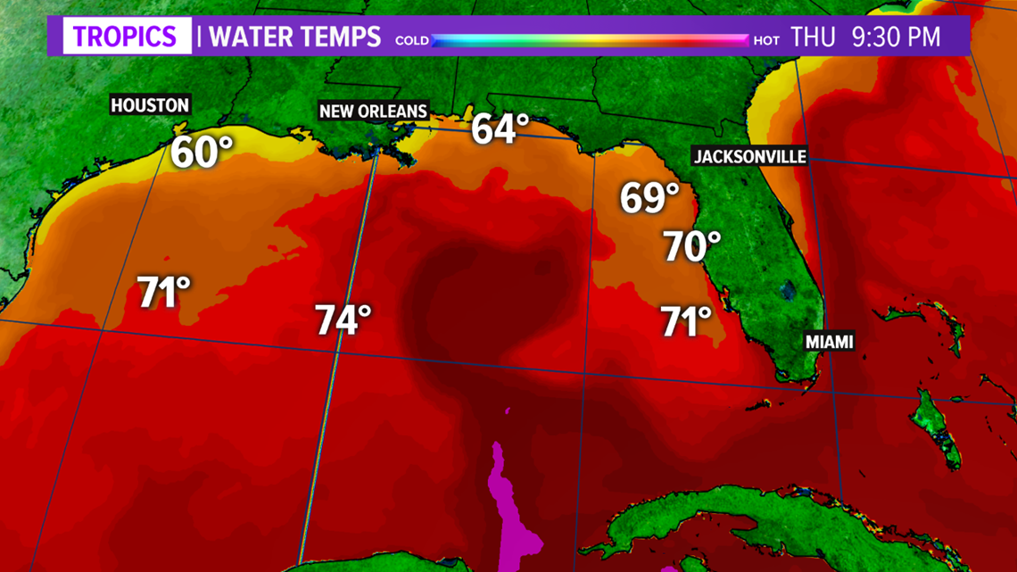
TEXAS, USA — The northwestern Gulf of Mexico is still recovering from the February Arctic intrusion that impacted Texas. As of early-March, water temperatures are well below average in this region.
The below average water temperatures will undoubtedly have an impact on convection and severe thunderstorms west of the Mississippi throughout March.


The Gulf of Mexico waters are an important variable in convection and severe thunderstorms for areas east of the Rockies. Generally speaking, when the Gulf of Mexico water temperatures are above average, this leads to more instability for convection and severe thunderstorms by supplying the atmosphere with added moisture and warmth. Instability acts as fuel for thunderstorms, and many times, the greater the instability, the stronger the thunderstorm if other variables are favorable. Thus, the added moisture and warmth bolsters instability, creating increased severe thunderstorms.
Research shows the warmer the Gulf of Mexico water temperatures, the more hail and tornadoes occur throughout March, April, and May. With the water temperatures running below average in the northwestern Gulf of Mexico, it is possible this will have implications on convection and severe thunderstorms throughout the month of March due to the decreased availability of moisture and warmth added to the atmosphere. This may lead to less intense convection or a decrease in tornado and large hail frequencies during the month of March for areas west of the Mississippi River. It should be noted: severe thunderstorms are still possible throughout March but the frequency and intensity may be impacted.
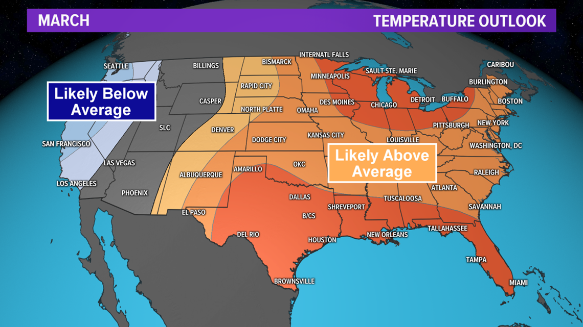
Above average temperatures are forecast for the region throughout March so this will allow the Gulf of Mexico water temperatures to slowly recover, possibly returning to average or even climbing above average by April, which may lead to an increase in severe weather during April and May for areas west of the Mississippi River.


