
BRYAN, Texas — The Fort Worth National Weather Service (NWS) confirmed Wednesday afternoon three tornadoes occurred last night in north Texas. The three tornadoes are: I) EF-3 in north Dallas, II) EF-1 near Rowlett and III) EF-0 north of Wills Point.
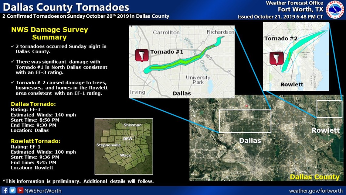
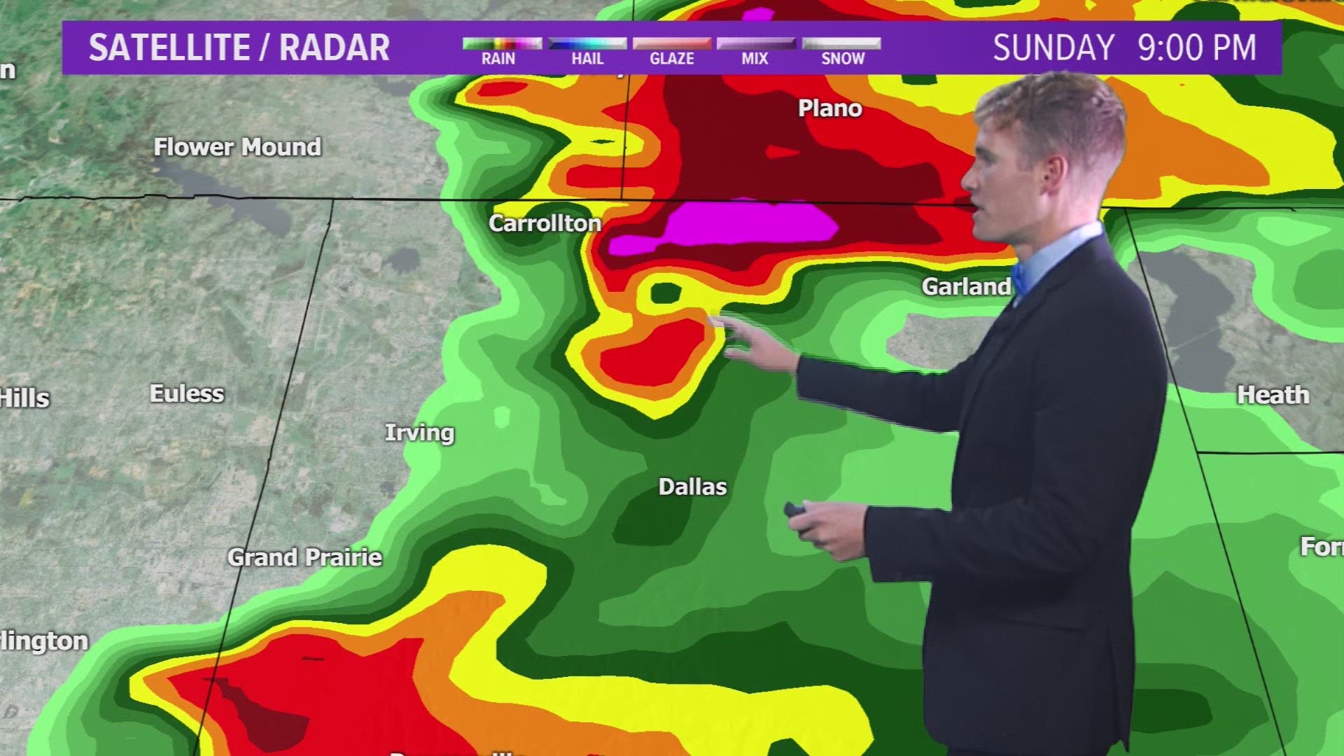
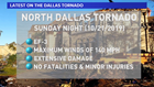
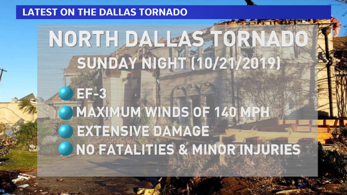
The most intense tornado was the EF-3 in north Dallas. The NWS estimates the winds peaked at 140 mph with this tornado that caused extensive damage within its path. The tornado's path length was 15.75 miles and had a maximum width of 1300 yards (almost 3/4ths of a mile wide). Despite the strong tornado, no fatalities occurred and only minor injuries were reported. While there were not fatalities and only minor injuries, the damage in the tornado path is significant. Several schools were damaged, including: Cary Middle School, Thomas Jefferson High School and Walnut Hill Elementary. The heaviest damage was reported near Walnut Hill Lane and the neighborhood of Preston Hollow where numerous homes are believed to be complete losses.
The severe weather event was well-predicted. The Storm Prediction Center (SPC) highlighted the area for possible severe thunderstorms several days in advance. Prior to the Tornado Warning, a Tornado Watch was issued by the SPC for all of north Texas, including Dallas. The Tornado Warning was quickly issued once the NWS indicated a tornado was in the process of developing.
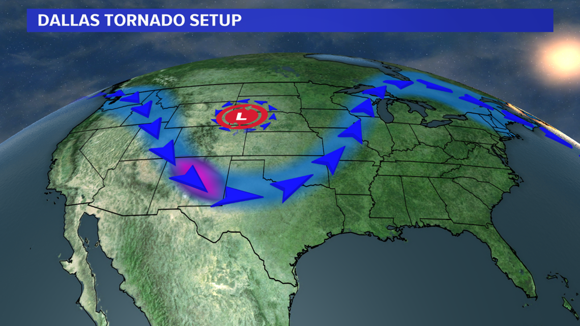
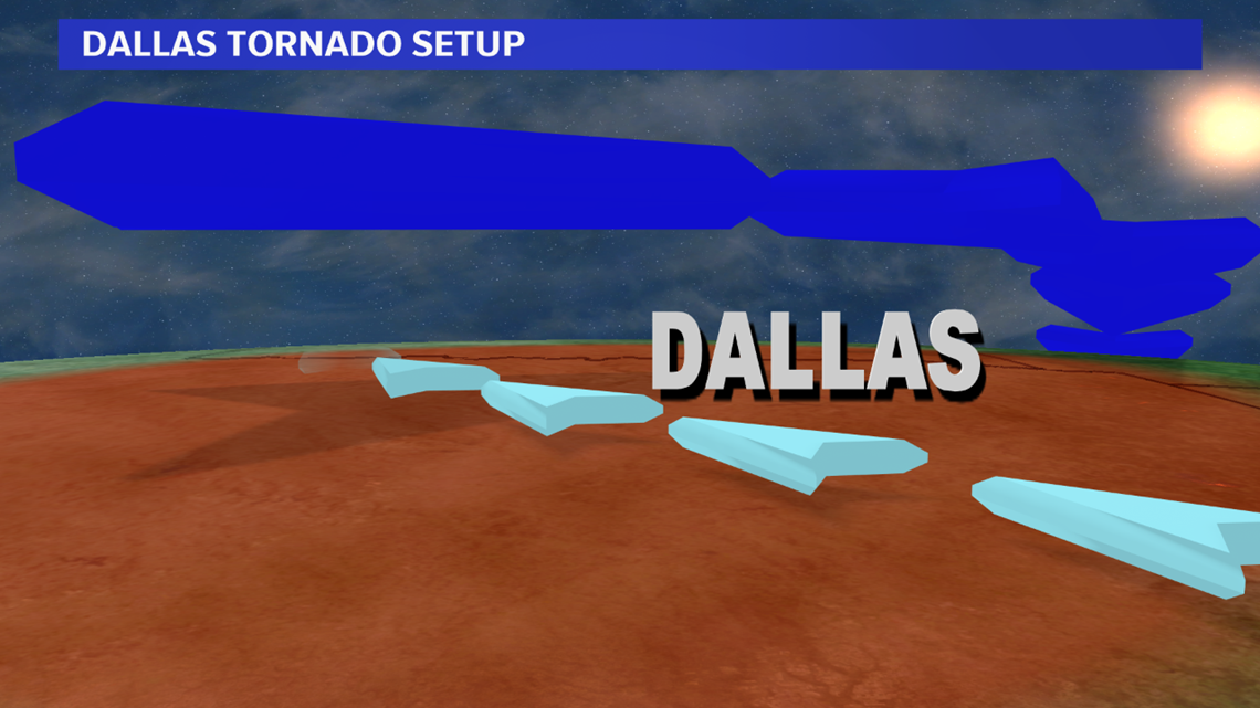
The worst of the severe weather was well north of the Brazos Valley. A deep dip in the jet stream was located over north Texas Sunday evening. With this jet stream are enhanced mid & upper-level winds from a westerly direction. At the surface, winds were a southeast direction (pulling in adequate Gulf moisture). This jet stream, with the fastest winds aloft, was also positioned well to place north Texas in a favorable region for rapidly ascending air. All of this paired with a touch of surface heating led to intense thunderstorms over north Texas, which led to tornadoes due to the direction and speed shear from where the jets fly down to the surface.


While the Brazos Valley was just removed from the best dynamics for severe severe weather, it is the second severe weather season for our region. It is important to make sure you have a plan in place in case a Watch or Warning is issued for your town.